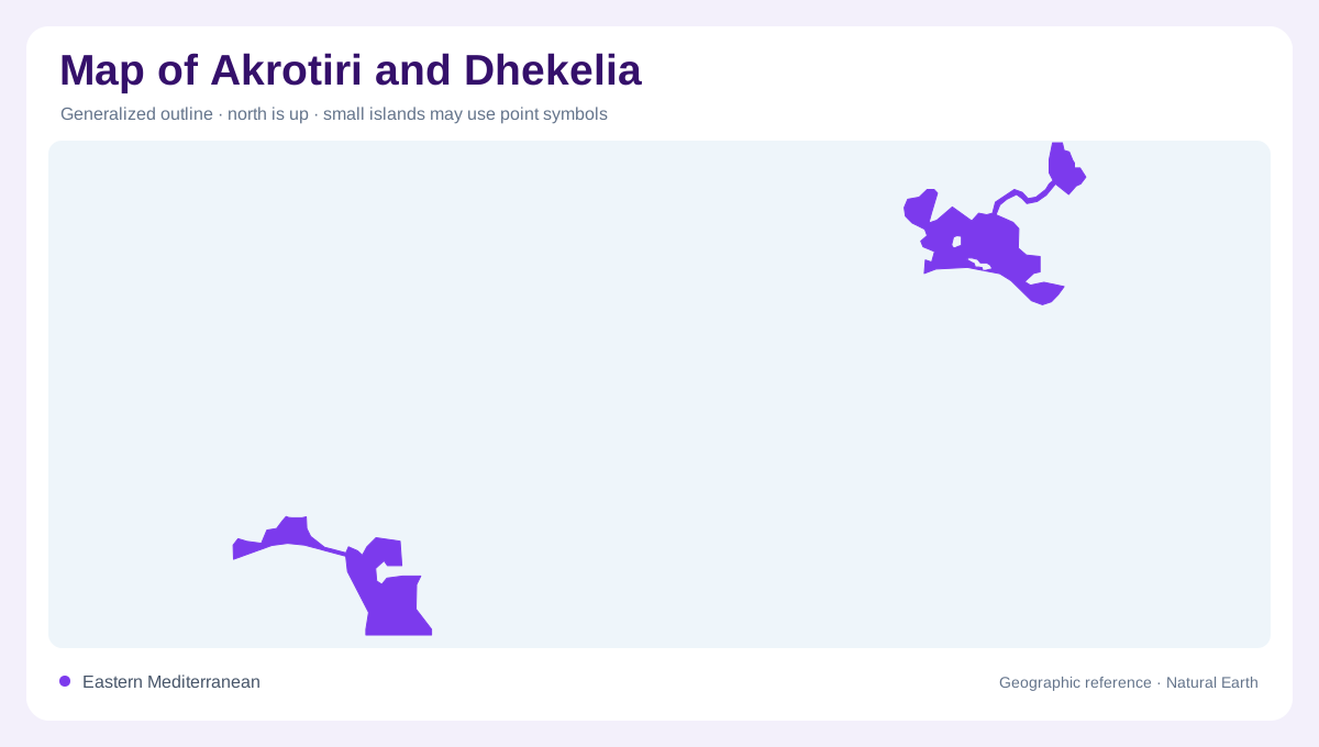
Two separated areas on Cyprus
Akrotiri and Dhekelia are two separate Sovereign Base Areas on the Mediterranean island of Cyprus. They are not a pair of offshore islands, nor do they form one continuous strip across the island. Their western and eastern locations need to remain distinct on a map covering the whole unit. Cyprus supplies the surrounding geographic context, while the base area boundaries identify particular portions of its land. A shared label can obscure this separation if placed without clear outlines. Reading the two areas independently first makes the compound name easier to understand and avoids joining places that lie in different parts of Cyprus.
The western area and its peninsula
The western area includes Akrotiri and Episkopi. Akrotiri's peninsula forms a particularly distinctive physical feature, projecting into the Mediterranean at the southernmost part of Cyprus. Its landform includes extensive wetland habitats rather than only buildings and operational sites. This distinction matters because the area boundary and the boundary of a military installation do not describe the same thing. A physical map should retain the peninsula, coast and wetlands as separate features. Their arrangement gives the western area a geographic identity that cannot be conveyed by a single base symbol or by colouring its entire outline as one built surface.
Salt lake and sand flats
At the centre of the Akrotiri peninsula, a salt lake and adjoining sand flats occupy the larger part of the Ramsar wetland site. The lake developed from a former lagoon that became separated from the sea. Saltmarsh vegetation surrounds it, creating transitions between open or seasonally wet ground and terrestrial habitats. The lake's setting should therefore be read as part of a coastal system rather than an ordinary inland freshwater basin. Rain is its main water input, although storms can introduce seawater. A fixed blue outline cannot capture every seasonal condition across such a shallow and variable wetland environment.
Fassouri's freshwater contrast
Northeast of the salt lake, the Fassouri marshes contain freshwater habitats, including reedbeds and grazing marsh. They are hydrologically connected with the wider Akrotiri wetland system but differ from the saline lake area. Treating both as one undifferentiated marsh would erase a significant ecological distinction. Their position relative to the central lake is also useful for orientation on a detailed peninsula map. Rainfall links the two areas, while vegetation and water conditions separate their local character. The wetland landscape thus contains connected but contrasting components within a geographic area small enough to be compressed into one symbol on regional maps.
The eastern area's separate geography
Dhekelia and Ayios Nikolaos belong to the eastern area, geographically separate from Akrotiri's peninsula. The connection between those eastern sites is an important part of their outline, but it does not extend to the western area as continuous territory. The compound entry therefore needs either a Cyprus wide overview or clearly labelled separate frames. Its boundaries also differ from the ecological limits described around Akrotiri. Keeping installations, area outlines and habitats distinct produces an accurate geographic reading. The result explains both the two-part territorial arrangement and the wetland complexity of its western component without making assumptions about present access conditions.