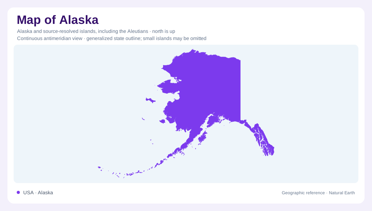
Several geographies within Alaska
Alaska combines an extensive northern mainland with a southeastern coastal extension and a long southwestern sweep of peninsula and islands. Those projecting regions are essential to its identity, rather than minor appendages to a central block. A statewide outline can establish their relationship, but it cannot convey the full contrast between Arctic river country and the sheltered fjords of the Pacific coast. Glaciated mountains, interior valleys, volcanic landscapes, and coastal wetlands occupy different parts of this enormous setting, with contrasting connections to rivers and seas. Understanding Alaska therefore begins with regional comparison, especially the distinction between waterways draining toward northern seas and landscapes facing the Pacific.
Arctic basins and the Brooks Range
In northern Alaska, the Brooks Range supplies a mountain framework for large river systems. The Noatak runs from this range toward the Chukchi Sea, linking inland mountain valleys with a coastal outlet. Nearby Kobuk Valley combines the Kobuk River with extensive sand dunes, a reminder that Arctic terrain is not uniformly rocky or permanently snow covered. River corridors also carry long histories of human use: Onion Portage on the Kobuk is associated with caribou harvesting across many generations. This northern geography is best understood through the relationship between mountains, river basins, and seasonal movement across the land.
Interior valleys and mountainous transitions
The Yukon and Charley rivers identify an interior landscape distinct from the deeply indented southern coast. Their valleys connect broad inland country, while Alaska's mountain landscapes can contain pronounced changes with elevation. In Denali National Park and Preserve, lower taiga forest gives way to alpine tundra and snowy high ground. This vertical sequence matters alongside the state's immense horizontal distances. A place can belong to the same general region yet have a very different setting because it lies above the forest rather than within a valley. Interior river country and alpine terrain consequently require separate attention within a statewide overview.
Fjords along the Pacific margin
On the Kenai Peninsula, the Harding Icefield feeds glaciers toward a coast shaped by ice. Kenai Fjords preserves a landscape where valleys carved by glaciers meet marine waters. Farther southeast, Glacier Bay combines sheltered fjords, mountains, glaciers, and temperate rainforest within the Inside Passage setting. These examples show why Alaska's southern shoreline cannot be interpreted as a simple edge between solid land and open ocean. Deep inlets penetrate mountain country, and ice connects high elevations with coastal environments. Sitka adds an island settlement reference in the southeast, emphasizing the archipelagic character of this part of Alaska's Pacific margin.
The peninsula and Aleutian extension
Southwestern Alaska continues through the Alaska Peninsula toward the Aleutian Islands. Volcanism is central to this region's landscape: Aniakchak preserves a large caldera, while Katmai includes the country affected by the Novarupta eruption. Water follows another important connection here. The Alagnak begins in the Aleutian Range and meanders west across the peninsula toward Bristol Bay and the Bering Sea. Beyond the peninsula, the Aleutians extend the state's island geography far into the North Pacific. Keeping peninsula, island chain, Arctic basins, and southeastern fjords distinct prevents a single image of wilderness from obscuring Alaska's diverse physical structure and coastal orientations.