A long Atlantic-facing country
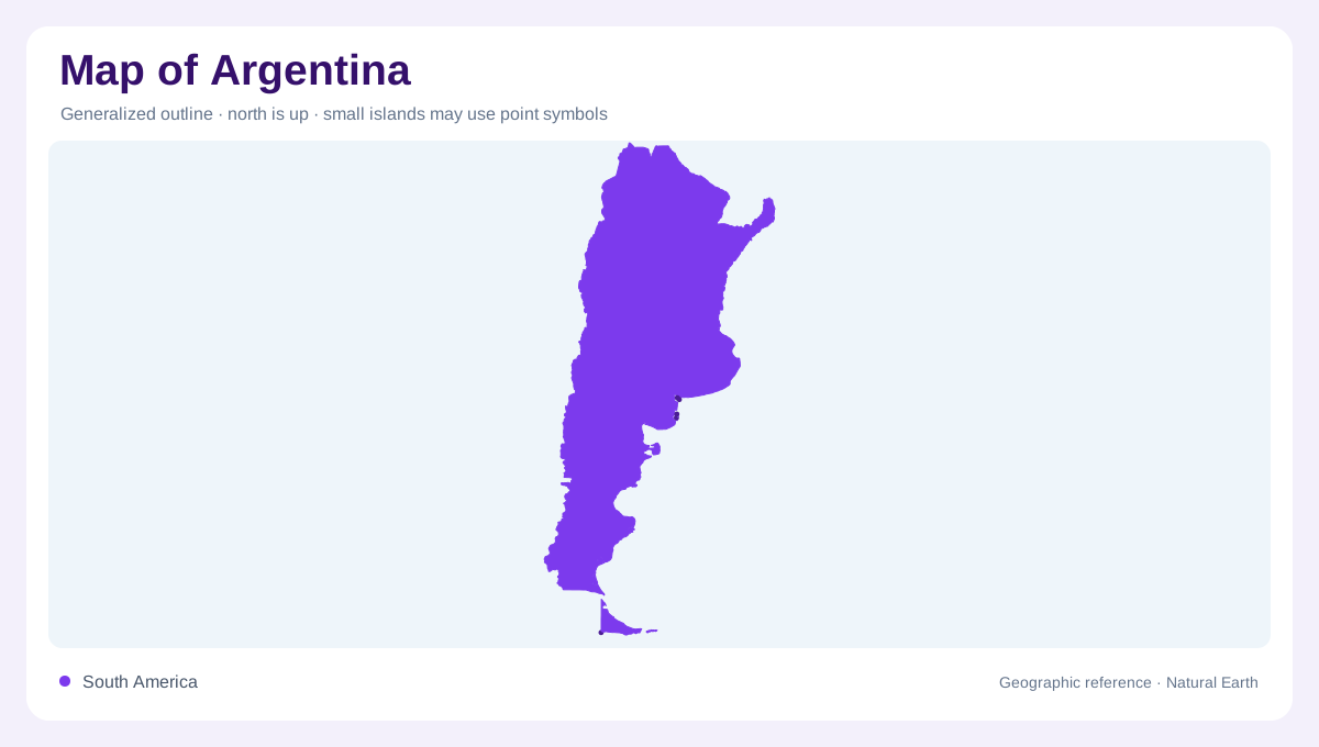
Argentina stretches through southern South America, with Chile along its western side and an extensive Atlantic coast along its long eastern continental edge. Bolivia, Paraguay, Brazil and Uruguay complete its neighbouring countries. The long north to south extent matters as much as total area: the highlands near Bolivia occupy a very different setting from the far southern islands. Buenos Aires stands beside the Río de la Plata, not on an inland central plateau. Its position helps anchor the eastern side of the country, while the Andes establish the dominant western mountain framework. Between these edges lie several contrasting plains, uplands and river basins.
Puna basins and mountain contrasts
Northwestern Argentina includes the Puna, a high Andean region containing salt crusted basins such as Salar de Arizaro. These dry lake surfaces occupy depressions among substantial mountain structures. Farther east, the Sierras Pampeanas have lower ridges separated by broad valleys, contrasting with the higher Puna. NASA's regional account links these differences to the underlying tectonic setting, where the Nazca Plate descends beneath South America at different angles. The terrain therefore cannot be summarised as a single wall beside a flat country. Mountain height, basin form and volcanic distribution vary across the transition from the western highlands toward the interior.
Pampas and the northeastern waterways
The Pampas form grassy lowland country in central Argentina, with extensive agricultural landscapes. They differ from the arid salt basins farther northwest. In the northeast, the Paraná and Uruguay provide major river axes, while the Paraguay, Pilcomayo and Bermejo connect additional northern catchments. The Río de la Plata forms the broad estuarine setting beside Buenos Aires. These waterways belong to an international drainage network, so upstream geography continues beyond Argentina's boundaries. Combining the river system with the plains helps explain the eastern landscape without assuming that every flat area belongs to the same basin or receives the same rainfall.
Patagonia's rivers across the south
Farther south, the Colorado, Río Negro, Chubut and Santa Cruz provide distinct river references across Patagonia. The Limay and Neuquén belong to the system feeding the Río Negro, connecting western waters with a major eastward river corridor. These names interrupt the misleading impression that southern Argentina is one empty, undifferentiated expanse. A river valley can form a narrow geographic axis within a much broader surrounding region. On a national map, its importance may be clearer than smaller local features, yet the space between rivers remains significant. Patagonia's scale is best understood through both its waters and the distances separating them.
Tierra del Fuego and map scope
At the southern end, Tierra del Fuego introduces an island geography distinct from mainland Patagonia. The main island is shared with Chile, and Ushuaia is an Argentine reference point there. A map confined to the mainland would therefore omit part of the country's inhabited southern landscape. Official Argentine maps may also display territorial claims beyond the areas described here; their depiction should not be read as resolving disputed sovereignty. This article follows the geographic sequence from northern basins to the southern island region, keeping that sequence separate from political claims and preserving the difference between mainland, island and ocean.