A chain spread across the Atlantic
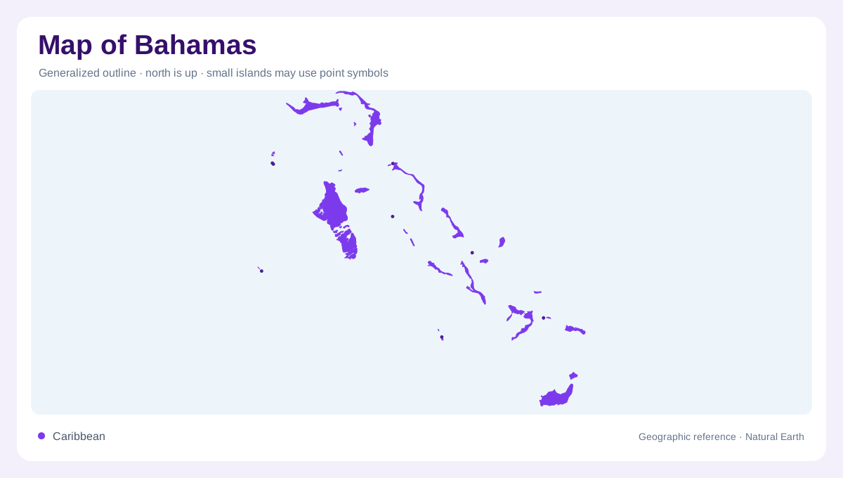
The Bahamas extends southeastward through the western Atlantic, beginning near Florida and continuing toward the northern Caribbean. It is an archipelago, not one large island divided into districts. Grand Bahama and Great Abaco anchor the northwestern part of the chain, while Great Inagua lies far to the southeast. Between them, islands, cays and broad water spaces create a discontinuous national outline. The sea between these pieces is central to the geography, separating settlements and defining the spaces around each island group. Compressing the whole country into a small locator can make neighbouring labels look adjacent even where substantial stretches of open water separate the places they identify.
Nassau is not on Andros
Nassau lies on New Providence, a separate island east of Andros. This distinction is especially useful because the capital's large label can visually dominate a small map, while Andros occupies much more land. North and South Andros appear as major named parts of the western island complex. New Providence is a different geographic unit, not its eastern urban district. Farther north, Freeport belongs to Grand Bahama, while Marsh Harbour identifies a settlement on Great Abaco. These pairings connect towns to the correct islands and prevent a map of the Bahamas from becoming a list of unanchored settlement names.
The banks below the surface
Many Bahamian islands stand beside extensive shallow marine platforms known as banks. The Little Bahama Bank in the north provides a particularly clear example. NASA imagery shows bright shallow water, a reef edge and a rapid transition toward darker, deeper ocean beyond it. The bank is not dry land, even when its pale colour makes it look like an enormous submerged island. It has its own sand patterns and channels. Tidal water moves through reef openings, rearranging sediment into sweeping forms. The visible island outline therefore captures only the exposed portion of a much broader shallow marine landscape.
Long islands and scattered cays
Eleuthera and Long Island illustrate the slender forms found within the central and southeastern chain. Exuma combines larger named islands with a succession of smaller cays, while Cat Island and San Salvador occupy separate positions farther east. Their elongated or fragmented shapes matter when comparing land area with the distances covered by a group. A chain of small cays can stretch across a considerable reach of sea without forming a continuous barrier. Conversely, a narrow island may have nearby opposite shores but widely separated ends. These arrangements give the Bahamas a geography of repeated coastlines rather than a deep interior.
Toward Inagua and the outer southeast
Crooked Island, Acklins and Mayaguana lead the eye toward the southeastern Bahamas, where Great and Little Inagua complete another distinct grouping. These names should remain separate from the neighbouring Turks and Caicos Islands, which are not part of the Bahamas. A regional frame makes the distinction clearer than a tightly cropped island map. From the Little Bahama Bank to Inagua, the country combines exposed land, submerged platforms and deeper channels. Its most informative outline is therefore not merely the edge of each island but the relationship between those edges and the different kinds of water surrounding them.