An archipelago within the Gulf
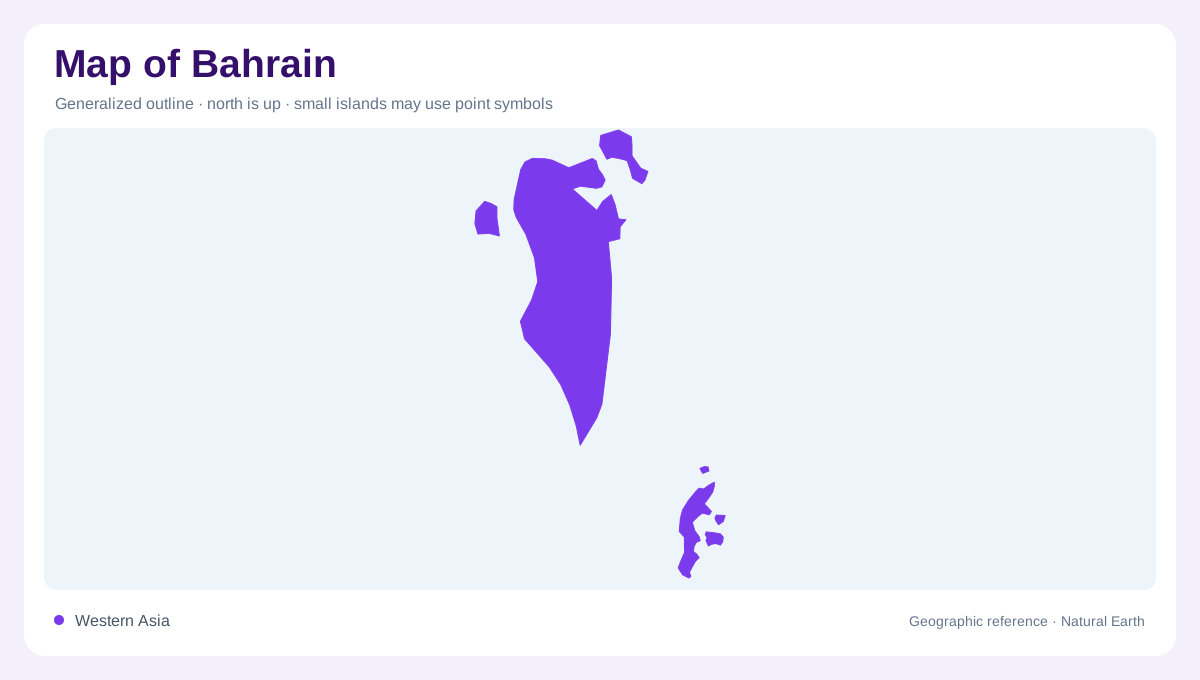
Bahrain lies in the Gulf between Saudi Arabia to the west and Qatar to the east. Although the country's name is also the name of its largest island, the national territory is an archipelago. A map showing only that principal landmass leaves the geographic picture incomplete. The surrounding sea creates separation between islands while placing them within a relatively enclosed regional water body. For orientation, locate the Arabian coast first, then distinguish Bahrain's islands from the neighbouring mainland. This sequence prevents a small scale map from making Bahrain appear to be a coastal district attached to a larger country.
The weight of the main island
The island of Bahrain contains the capital and dominates the country's land area. That concentration explains why a national overview can appear strongly centred on one island even when its title refers to the entire state. The shoreline deserves particular care because a coastal map records an outline at a particular date and resolution. Tiny offshore features may be generalized or omitted. Comparing differently scaled maps can therefore produce apparent disagreements that do not concern the main island's position. Separate the broad arrangement of land and sea from questions about individual waterfront parcels, narrow channels and detailed coastal boundaries.
Dry ground beside humid water
Bahrain's maritime surroundings do not make it a rainy landscape. Its climate is arid, with limited and irregular rainfall despite humidity supplied by the surrounding Gulf. This combination is useful for interpreting the difference between atmospheric moisture and dependable freshwater. A coastal location can feel humid while still supporting sparse natural vegetation and requiring careful water management. The absence of perennial naturally flowing surface streams is another defining feature. Unlike a river delta, Bahrain cannot be understood through a branching network of major surface channels. Relief, soils, groundwater and the distribution of developed land carry more explanatory weight than river lines here.
An aquifer crossing the national outline
Beneath the surface, Bahrain connects to a regional groundwater system extending from Saudi Arabia. FAO describes groundwater movement through the Dammam aquifer toward Bahrain, illustrating a physical relationship invisible on an ordinary political map. The national coastline does not form a watertight boundary underground. Fresh groundwater and surrounding saline water interact, and intensive extraction can alter that balance. Consequently, a well symbol indicates a location, not a guarantee of freshwater quality or sustainable supply. Reading Bahrain's water geography requires considering subsurface connections alongside rainfall, rather than treating each island as a completely independent reservoir enclosed by the sea.
Coastal cultivation and competing space
Agricultural land has historically been concentrated along the northwestern coastal strip, with additional pockets elsewhere on the main island. This distribution reflects the combined availability of soil and usable water rather than an even agricultural cover. Sandy soils and salinity help explain why green areas should be examined individually. Coastal development can occupy the same limited ground that once supported fields, so an older land use map may differ substantially from a newer one. Bahrain is thus best read through several related layers: the archipelago's outline, the main island's concentration of settlement, the dry surface environment and the less visible groundwater system.