Two parts on Borneo's northern coast
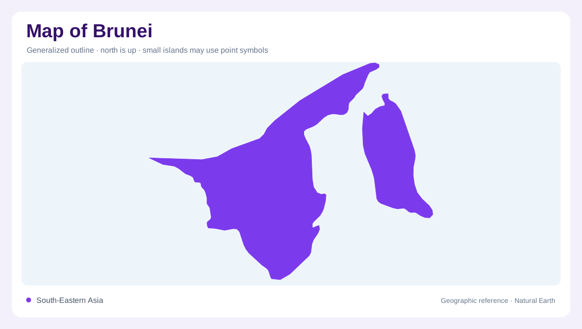
Brunei occupies part of Borneo's northwestern coast, facing the South China Sea. It is not a separate island: its land belongs to the much larger island shared with Malaysia and Indonesia. Brunei's outline is unusual because Temburong is geographically separated from the western part of the country by Malaysian territory. A single continuous patch would therefore misrepresent the national shape. The surrounding state of Sarawak is important context, especially when following the inland boundary. From a regional perspective, Brunei combines a coastal orientation with an interior that rises into Borneo's forested terrain rather than ending at the shoreline.
Four districts, different positions
Brunei-Muara, Tutong, Belait and Temburong are the country's four districts. The first three belong to the western portion, while Temburong forms the separate eastern component. This arrangement makes district names particularly useful for understanding the outline. Brunei-Muara is associated with the capital region and the Brunei River, whereas Belait extends across the country's western side. Tutong lies between these western reference areas. Temburong must be located independently rather than imagined as another neighbourhood beyond the capital. Administrative geography here captures a real discontinuity in the land, even though all four districts belong within the same national description.
Wetlands beside the coast
Brunei's forests include mangroves, freshwater swamps and peat swamps as well as forests on firmer ground. These categories reflect different relationships with water, from tidal shorelines to saturated ground beyond the coast. Mangroves occupy coastal environments influenced by tides, while freshwater and peat swamp settings belong to other lowland conditions. A uniform green forest symbol conceals these distinctions. Near the shore, river mouths and wet ground help organise the landscape, so the boundary between land and sea is ecologically more complex than a simple line. The forest classification also cautions against treating every low elevation area as cleared land or assuming all woodland occupies steep inland slopes.
Rainforest toward the interior
The interior includes mixed dipterocarp forest, heath forest known as kerangas, and montane forest. Brunei's humid tropical climate supports this variety, with rainfall generally greater inland in the FAO geographic account. Elevation, soils and drainage help distinguish the different forest environments. Temburong contains Ulu Temburong National Park, a substantial rainforest area in the separate eastern district. Its position gives that component a geographic identity beyond being a detached piece of the outline. The park belongs to the forested interior, while the district also connects toward lower river country; neither its entire terrain nor its settlement pattern is simply coastal.
Reading the Sarawak boundary
A NASA image of the Brunei-Sarawak border shows how land cover can differ across a political boundary, contrasting forest with areas cleared for cultivation in the photographed scene. Such imagery records a particular date, not a permanent statement about every part of either side. Nevertheless, it illustrates why border lines and vegetation patterns sometimes align. Brunei's geography emerges from several overlapping structures: the separated national outline, four districts, coastal wetlands and rising forest country. Keeping each layer distinct reveals a small state embedded within Borneo's much larger river, forest and mountain landscape, rather than isolated from its neighbouring terrain.