A long transition inland
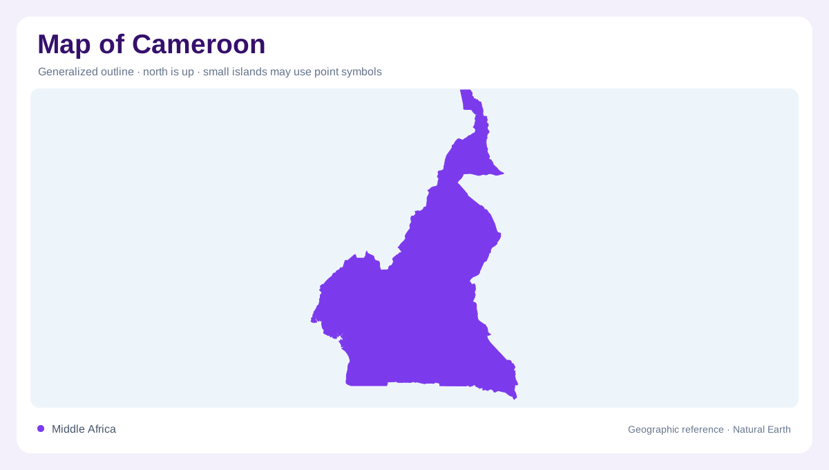
Cameroon stretches from the Atlantic coast into the Lake Chad basin, crossing strikingly different landscapes within one national outline. Its southern breadth contrasts with the narrower extension reaching northward. On a continental map, this shape connects the humid forests of Central Africa with the drier environments approaching the Sahel. Latitude explains part of the change, but elevation complicates any simple division into northern and southern halves. The western mountains, central Adamawa plateau and low coastal plain should therefore be read together. They establish the framework within which vegetation, rivers and settlement occupy substantially different environments over relatively short horizontal distances.
Mountains beside the Atlantic
The western highlands continue southwest toward Mount Cameroon, bringing pronounced relief close to the ocean. This arrangement makes the coastal margin unusually instructive: a small distance inland can correspond to a considerable rise in elevation. Plains around the estuaries differ from the adjoining mountain slopes, even where both appear close together on a country overview. Farther north, the western uplands form an extensive elevated region rather than a single isolated summit. A shaded relief map helps distinguish these uplands from the lower terrain alongside them. Contours clarify where steep slopes interrupt the apparent continuity of the coastal and inland landscapes.
Adamawa separates river directions
Across central Cameroon, the Adamawa plateau is a major organizing feature for drainage. Water leaving different sides of the uplands ultimately follows different continental routes. The Benue system carries northern drainage toward the Niger, while the Logone system connects the far north with Lake Chad. Southeastern rivers including the Kadei and Ngoko feed the Sangha and then the Congo. Elsewhere, rivers descend directly toward the Atlantic. These connections explain why a national boundary does not enclose a single watershed. Following tributaries beyond Cameroon reveals relationships that disappear when a map is cropped tightly around the country's perimeter without regional context.
Coastal rivers and wet margins
The Sanaga is a prominent river of the central and western drainage network, while the Nyong, Ntem, Mungo and Wouri provide additional Atlantic outlets. Their estuaries and lower valleys belong to a wetter landscape than the northern plains. Mangroves occupy parts of the coast between the Wouri estuary and the Nigerian boundary. Inland, lakes add another layer of variety: volcanic lakes such as Nyos and Barombi Mbo should not be interpreted as fragments of one continuous lowland water system. Their enclosed settings contrast with broad river floodplains. Distinguishing lakes, estuaries and seasonal wetlands makes the water pattern considerably more intelligible.
Northern plains and seasonal water
Beyond Adamawa, the Benue lowlands and the plains toward Lake Chad replace the southern forest landscape. The Mandara Mountains introduce another elevated area within this northern geography, so the region is not uniformly flat. Around the Logone, floodplains known as yaeres reflect seasonal inundation rather than permanent lake conditions. Rainfall generally diminishes northward, and the dry season becomes longer. A water symbol consequently needs interpretation alongside season and landform. Comparing these northern floodplains with the Atlantic mangrove margin brings Cameroon's geographic range into focus: both are wetland environments, yet their water sources, surrounding relief and annual rhythms are fundamentally different.