Three islands south of Cuba
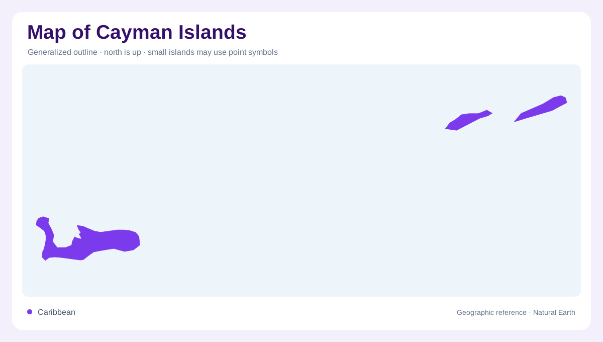
The Cayman Islands occupy the western Caribbean south of Cuba and northwest of Jamaica. The territory consists of Grand Cayman, Cayman Brac and Little Cayman, with sea separating Grand Cayman from the other two. This arrangement matters before any local detail is considered. The group is not a single island divided into three districts, nor are the islands immediately adjacent along one continuous reef shoreline. A regional map should show their relative positions within the Caribbean. A closer overview can then distinguish each landmass without compressing the intervening water so much that their geographic relationships become hard to recognize.
Grand Cayman and the capital
George Town, the territorial capital, is on Grand Cayman. That association gives a first anchor for reading place names across the group: a reference to the capital should not be transferred to Cayman Brac or Little Cayman. Grand Cayman also contains the West Bay district and the Barkers coastal area identified by the official tourism authority. These locations belong within one island frame, while the other two islands require separate treatment. Keeping the capital and island names distinct prevents an administrative label from replacing a geographic one. George Town is a settlement within Grand Cayman, not a synonym for all three islands.
Cayman Brac's elevated landmark
Cayman Brac lies northeast of Grand Cayman and is the second largest island in the territory. Its bluff is a defining landform, introducing a conspicuous raised feature into the island's geography. Limestone caves provide another expression of its rock structure. The eastern edge of the bluff is prominent in the official island account, and Peter's Cave is associated with that landscape. A relief map therefore contributes information that the coastline alone cannot show. The Brac's identity depends partly on vertical form, so enlarging its outline without representing elevation would still leave out one of the island's most characteristic physical features.
Little Cayman beside the Brac
Little Cayman lies west of Cayman Brac, much closer to it than either island is to Grand Cayman. The official tourism description gives its approximate dimensions as ten miles long and one mile wide. That elongated shape helps explain why an island overview and a shoreline detail communicate different things. Beaches occupy parts of its coast, but a beach label does not describe the entire island perimeter. Its separate name and outline should remain visible alongside the Brac. The two neighboring islands form a pair geographically, yet neither should be treated as an offshore district within the other's land area.
Distance is part of the island geography
An inset that places the three Cayman islands together can make their individual shapes legible, but its scale determines whether their separation remains accurate. Grand Cayman's distance from the northeastern pair is a central part of the territory's spatial structure. At the larger Caribbean scale, Cuba and Jamaica provide useful neighboring reference points without implying any land connection. At local scale, George Town, Barkers and the Brac's bluff identify kinds of features: settlement, coastal landscape and elevated terrain. Combining these scales gives the islands geographic individuality while preserving the three part arrangement that defines the territory as a whole.