An isthmian country with an offshore component
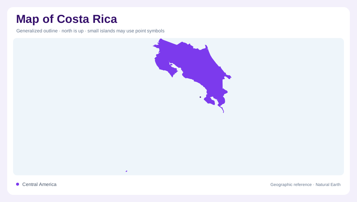
Costa Rica lies between Nicaragua and Panama, with Caribbean water to the east and the Pacific to the west and south. Its position within Central America brings two marine margins into one compact national frame. The country's territory also includes Cocos Island in the Pacific, which belongs on a wider ocean locator rather than being assumed to sit beside the mainland. Mountain ranges organize the continental interior, while peninsulas project into the Pacific. Together, these features make the national geography more complex than a narrow land bridge. Coastlines, uplands and offshore territory each require attention at an appropriate spatial scale.
The Central Valley between mountain systems
San Jose, Heredia, Alajuela and Cartago locate the principal urban concentration in the Central Valley. This interior setting sits within a broader arrangement of mountain ranges rather than on a broad coastal plain. The Guanacaste and Tilaran uplands extend from the northwest toward the country's middle, while the Central range includes the volcanoes Irazu and Poas. Farther southeast, the Talamanca range continues toward Panama. These named ranges establish a framework for reading the valley's position. The cities are therefore related by their shared interior geography, even though administrative boundaries divide the surrounding metropolitan and agricultural landscapes into several separate units.
Caribbean plains below the uplands
Humid, forested plains extend through the northeast and along the Caribbean side. Their lower relief contrasts with the central mountain country, creating a marked change over comparatively short distances. Moist air and topography contribute to the region's rainfall pattern, which differs from the more clearly separated wet and dry seasons on much of the Pacific side. A single national climate label consequently misses an east to west contrast. Rivers descending from uplands connect these environments, but the plains have their own spatial character. The transition from slopes to low ground helps explain why coast and interior look different on relief maps.
Nicoya and Osa shape the Pacific margin
The Nicoya Peninsula projects into the Pacific in the northwest, while the Osa Peninsula forms a separate projection in the southwest. Between them lies a Pacific coastal belt bounded inland by mountain terrain. These peninsulas are not islands, even where surrounding bays make their outlines appear nearly detached. Their positions also distinguish two parts of a long, irregular shoreline. The northwestern Chorotega region is comparatively less humid and has a dry season. Farther along the Pacific side, conditions differ, so Nicoya and Osa should not be treated as interchangeable examples of one uniform coastal environment or one continuous peninsula.
Height adds another climatic dimension
Elevation introduces cooler conditions above the tropical lowlands, adding a vertical pattern to Costa Rica's coastal contrasts. The Central Valley and higher mountain terrain therefore cannot be understood solely from their latitude. Relief influences rainfall distribution as well as temperature, producing local differences between slopes and sheltered settings. Forest, farmland and settlement occupy this varied terrain rather than a single climatic surface. At national scale, the two oceans and mountain ranges provide orientation; closer inspection reveals valleys, volcanic uplands and coastal plains. Cocos Island then extends the picture offshore, completing a geography that includes more than the mainland isthmus alone.