A maritime country with limited height
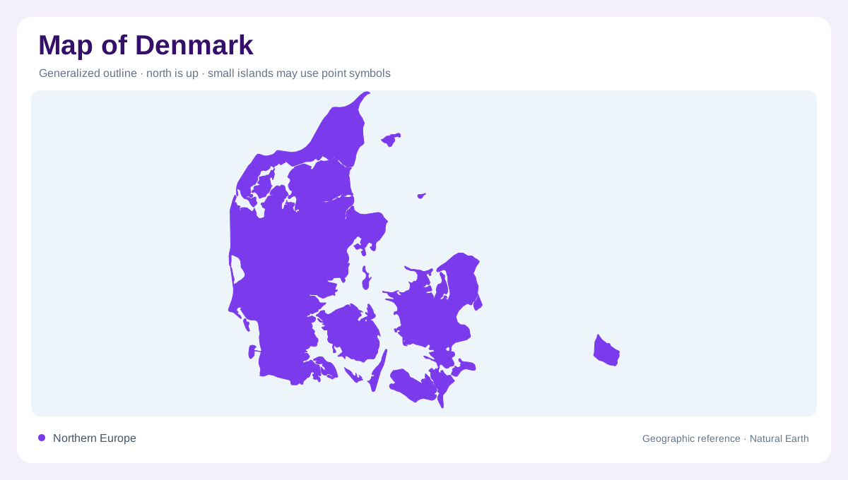
Denmark's geography is defined by proximity to the sea and comparatively low relief. Its territory includes a mainland peninsula and many islands, creating frequent alternation between land and water. A national overview should preserve those separations rather than merging the islands into an apparently continuous coast. Denmark also needs to be distinguished from the wider Realm, which includes Greenland and the Faroe Islands. Those territories have very different physical settings and receive separate geographic treatment. Denmark's landscape is predominantly low, with no point far from the sea, so coastal processes matter even where the map emphasizes inland settlement.
Jutland and the islands across the water
Jutland forms Denmark's mainland peninsula, with its western coast facing the North Sea. Fyn and Zealand are separate large islands, while Bornholm and Samsø add other island settings to the national picture. Copenhagen's island location is another reminder that Denmark cannot be understood through Jutland alone. Beaches, coastal towns and wooded landscapes recur across these regions, but the water between them remains a fundamental division. North Jutland has sandy environments, contrasting with more cultivated island scenery. Names such as Fyn and Zealand identify actual landmasses, not simply districts on a continuous mainland, so their separate outlines carry essential geographic information.
Dunes, heath and open habitats
Sand dunes, heath, bogs and other open habitats contribute to Denmark's terrestrial landscape. These environments should not be grouped together simply because they lack tall trees. Dunes express coastal sediment movement, while bogs involve waterlogged ground and a different set of physical conditions. Their distribution gives detail to a country sometimes described too broadly as flat farmland. Small changes in elevation, soil and moisture can separate neighboring habitats. At local scale, those differences are often more informative than a national height range. Denmark's modest relief therefore supports geographic variety without requiring the dramatic mountains familiar from other northern European countries.
Forests and managed countryside
Danish woods include both deciduous and coniferous trees, with substantial areas managed for production. Forest cover is therefore not automatically evidence of untouched natural woodland. Agricultural ground, woods and settlements form a landscape shaped by long use as well as underlying soils and drainage. A land cover map can distinguish those uses, but a closer reading should also consider the smaller open habitats between them. The environmental pattern is a mosaic rather than two exclusive categories of forest and field. This is especially relevant in a compact country where natural and managed areas frequently occur close together across the same lowland terrain.
Inland water and the wider realm
Streams, lakes and wetlands add freshwater environments within Denmark's maritime frame. They differ from coastal lagoons and marine waters despite sometimes occupying nearby low ground. Their ecological and geographic relationships depend on catchments, shoreline connections and local drainage. The same distinction in scale applies to the Realm: Greenland's ice dominated terrain and the Faroes' steep North Atlantic islands should not be imported into an account of Denmark's own lowlands. Keeping the territorial scope explicit produces a clearer map. Denmark's characteristic combination is low relief, abundant coastal edges, varied wet habitats and managed countryside, with sea and land closely interwoven throughout.