A Baltic mainland with an island fringe
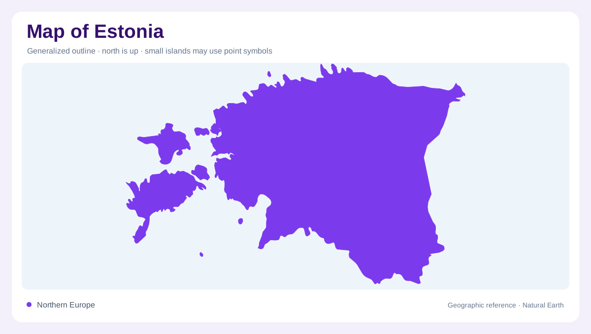
Estonia occupies the northern end of the Baltic states, combining a mainland with numerous islands in the Baltic Sea. The distinction matters immediately: its western outline is an intricate arrangement of channels, bays and separate landmasses, not a single smooth coast. Farther inland, lowlands, wetlands and modest uplands replace the maritime scenery. Ice age processes helped shape these contrasting surfaces. Estonia therefore rewards attention to relatively small differences in elevation rather than dramatic mountain chains. A shallow basin may hold a wetland, while nearby higher ground carries a different pattern of vegetation and settlement within the same broad northern landscape.
Saaremaa, Hiiumaa and the western islands
Saaremaa is Estonia's largest island, followed by Hiiumaa. Their size makes them prominent on a national map, but smaller neighbors help explain the complexity of the western coast. Muhu lies beside Saaremaa, while Vormsi forms another distinct island landscape. Beaches, wooded areas and rocky coastal features vary between islands rather than repeating one shoreline type. Hiiumaa's Kõpu peninsula is associated with its historic lighthouse, a useful named reference within the island's outline. These islands belong in the main geographic account, not merely as decorative offshore dots: together they greatly extend Estonia's interaction between terrestrial habitats and the surrounding Baltic waters.
Northern limestone and southern sandstone
The country's bedrock varies from limestone in the north to Devonian sandstone farther south. Above it, glacial deposits and uneven terrain produce a varied surface of higher ground and wetter depressions. Rock type alone does not dictate every visible feature, but it helps distinguish the northern and southern landscape settings. Estonia also spans a climatic transition: western districts feel stronger maritime influence, while eastern areas have more continental conditions. These differences operate across a comparatively compact country. Reading climate, bedrock and relief together gives a more informative picture than assuming that every inland district resembles the exposed western island shores.
Soomaa and the expanding flood landscape
Southwestern Estonia contains Soomaa, where bogs meet forests, rivers and flood meadows. Its celebrated fifth season describes flooding associated with spring thaw or heavy rain, rather than a fixed extra month in the calendar. Water can spread beyond ordinary river channels into surrounding low ground. A dry season map of land and water therefore captures only one state of this landscape. The park illustrates why wetlands should not be treated simply as unused spaces between settlements. Their extent, vegetation and connection to rivers reveal how water moves through the terrain, temporarily joining areas that usually appear separate on the ground.
Lake islands are not Baltic islands
Estonia's islands are not exclusively marine. Piirissaar lies in Lake Peipsi on the country's eastern side, giving it a freshwater setting quite different from the western archipelago. Ruhnu, by contrast, occupies the Gulf of Riga, while Aegna and Naissaar lie off Tallinn on the northern coast. These examples show why the surrounding body of water belongs beside every island label. A national overview that groups all islands together misses substantial geographic distinctions. From Peipsi's lake shore to Baltic sea channels and Soomaa's changing floodplain, water organizes Estonia at several scales, with each setting contributing a different pattern of land edges.