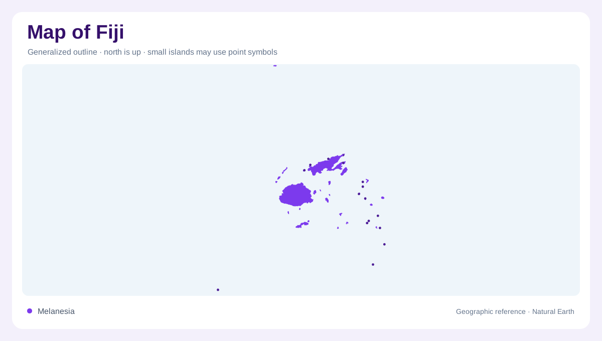
Large islands within a dispersed country
Fiji lies in the South Pacific, where Viti Levu and Vanua Levu account for most of the country's land area. Taveuni and Kadavu are other substantial islands, while numerous smaller islands extend the geographic picture well beyond the two largest outlines. The archipelago includes volcanic high islands, raised coral islands, atolls and sand cays. These are different landforms, not merely smaller versions of one standard island. Rotuma also belongs in the country's account rather than disappearing beyond the main group. A useful overview therefore needs both a broad oceanic frame and closer attention to the contrasting shapes within individual islands.
Viti Levu's mountains and urban margins
Viti Levu has a mountainous interior, with lower slopes and flatter coastal land creating a varied terrain around it. Suva lies in the island's southeast, within the broader Suva and Nausori urban area. Nadi provides a western reference. Their positions help orient the island without suggesting that its interior is simply empty space between coastal settlements. Forest, secondary vegetation, grassland and cultivated ground occupy different parts of the relief. Sugarcane is one conspicuous agricultural use in Fiji's lowlands. The relationship between higher interiors and more level ground is essential to understanding why land use changes across the island's short distances.
Rivers reveal the high island structure
The Rewa is a major river of Viti Levu, with the Wainibuka and Wainimala among its tributaries. The Nadi, Navua, Ba and Sigatoka provide other important drainage references on the island. Vanua Levu has its own river network, including the Dreketi. These names distinguish separate catchments rather than one national water system. Mountainous terrain gives the larger islands permanent surface water, a sharp contrast with many smaller, low islands. River maps consequently reveal a fundamental difference within Fiji: high ground can support branching drainage networks, while a low coral setting may have little or no permanent surface flow at all.
Rainfall and freshwater vary between islands
Fiji's climate is tropical and maritime, with a wetter season generally extending from November through April and a drier period from May through October. The pattern is not geographically uniform. Rainfall differs between islands and across their terrain, so a national seasonal label should not imply identical local conditions. Small low islands may depend on groundwater and collected rainfall rather than perennial streams. On larger islands, reservoirs add another component to water storage. Monasavu, on Viti Levu, is a named example. Distinguishing rain, river flow, groundwater and stored water explains more than assuming abundant surrounding ocean means abundant usable freshwater.
Reefs and wetlands beyond the land edge
Fiji's marine geography includes lagoons, coral reefs, seagrass environments and both sheltered and exposed shores. Mangroves and estuaries occupy coastal settings where terrestrial and marine processes meet. These habitats extend the country's environmental story beyond the dry island outlines. A mountain stream, its lower river and a coastal wetland can belong to connected systems, while offshore reefs introduce different structures beneath the sea. Taveuni, Kadavu and the many smaller islands must also be understood within this marine setting. Fiji's diversity arises from combinations of relief, geological origin, water and isolation, rather than from an undifferentiated scattering of tropical island coastlines.