A mainland reaching into several seas
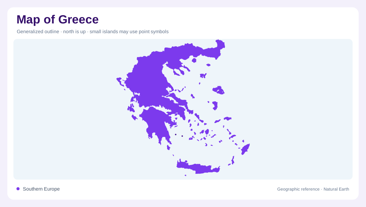
Greece occupies the southern end of the Balkan Peninsula and extends through numerous islands in the surrounding Mediterranean waters. Albania, North Macedonia, Bulgaria and Turkey border its mainland north and northeast. The Ionian Sea lies to the west and the Aegean to the east, with Crete marking a southern island position. This arrangement makes the coastline important to the country's outline, but it does not make the interior uniformly low. A full map needs the mainland, projecting peninsulas and separated island groups together. Cropping to Athens or the central Aegean would conceal much of that national geographic range.
Mountains close to coastal plains
Mount Olympus rises on the eastern mainland and is Greece's highest mountain. Its foothills stand above nearby alluvial plains, giving a compact example of the country's sharp transitions between low ground and high relief. Deep valleys dissect the massif, on its northern and eastern sides. This is a more informative physical picture than a summit icon alone. At regional scale, Olympus also demonstrates why coastal proximity does not imply a gentle landscape. Ground can rise steeply within a short distance inland, while adjacent plains occupy different settings. Contours preserve those relationships where a simple coastline and town map would hide them.
Vegetation climbing the Olympus slopes
The Olympus landscape changes with elevation, from Mediterranean shrubland on lower slopes through woodlands and forests to montane grassland and alpine terrain. Black pine is a forest component within the mountain setting. These vegetation belts help explain relief without reducing the massif to a single bare peak. They also show why a map of protected land needs a physical background: one boundary can contain several distinct environments. Nearby communities such as Litochoro and Dion occupy the foothill region rather than the summit landscape. Their positions make sense when the mountain, dissecting valleys and surrounding lower ground are read together.
Peninsulas and island groupings
The Peloponnese forms a large southern peninsula connected to the rest of the mainland at the narrow Corinth region. Farther north, smaller peninsulas create additional coastal indentations, while the islands introduce separate landmasses across the Aegean and Ionian seas. The Cyclades occupy the central Aegean, the Dodecanese lie farther southeast, and the Ionian Islands follow the western maritime side. These groups are geographic organisers rather than copies of one island type. Their shapes, elevations and distances vary. A regional view should preserve the sea gaps between them instead of arranging enlarged islands as though they were adjacent pieces of a single shore.
Crete and the scale of the whole country
Crete is a mountainous island south of the mainland and central Aegean. Its long outline deserves detail of its own, just as mainland mountain basins do. The contrast between island and mainland does not neatly separate rugged from level terrain: both contain high ground and lower coastal pockets. Athens in Attica and Thessaloniki in the north provide useful urban anchors, but the country's physical structure extends far beyond their surroundings. Reading Greece through mountain relief, peninsulas and island group positions explains that wider structure. The surrounding seas connect the picture visually while remaining real separations between distinct pieces of land.