An archipelago behind the butterfly outline
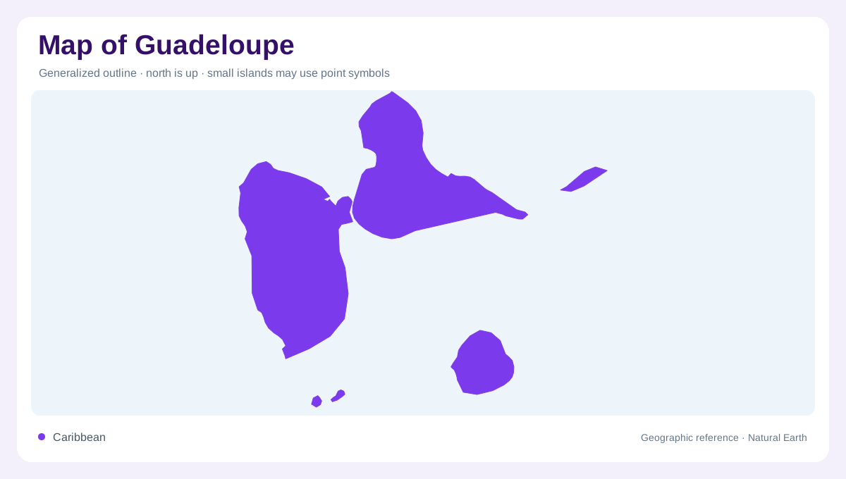
Guadeloupe lies in the Lesser Antilles, where its two principal islands create a butterfly shaped outline. Basse-Terre forms the western part and Grande-Terre the eastern part. Their close association should not hide the archipelago, which includes Marie-Galante, La Désirade and Les Saintes. These separated islands require their own positions and coastlines on a complete territorial map. The name Guadeloupe therefore identifies more than the paired main islands. At Caribbean scale, the chain establishes the setting; at local scale, narrow channels, offshore distances and contrasting island relief explain how the parts fit together without becoming one continuous landmass.
Basse-Terre rises toward Soufrière
Basse-Terre contains mountainous terrain and tropical forest, with La Soufrière forming its volcanic high point. The name should not be interpreted literally as evidence of low relief. Streams descend through this wetter upland landscape toward the surrounding coast, linking forested catchments with lower valleys and shorelines. A shaded map makes the central heights clear, while closer contours reveal the steepness between nearby places. Volcanic terrain and rainforest together distinguish this western island from the lower eastern part of the main pair. A common coastline colour cannot communicate that contrast, even when both islands appear similar in area on an outline.
Grande-Terre and the northern marine space
Grande-Terre lies east of Basse-Terre and presents a different terrain profile. The Grand Cul-de-Sac Marin opens between the northern sides of the two islands, creating a marine environment rather than another inland valley. Its lagoon, reefs and shallow margins deserve separate interpretation from the steep western catchments. On a small map, the bay can look like unused space inside the butterfly's northern outline. In physical terms it is one of the archipelago's important connecting environments. The position of reefs and shallow ground helps distinguish the open sea from sheltered lagoon waters without assuming that every blue area has similar depth.
From mangroves to coral reefs
The Grand Cul-de-Sac Marin contains mangrove forests, mudflats, seagrass beds, coral reefs and freshwater wetland environments. These habitats occupy different positions along the transition from land to sea. Mangroves and swamp forests are not interchangeable labels, and submerged seagrass should not be confused with exposed coastal vegetation. A habitat map can make these relationships visible where an ordinary coastline cannot. The bay also links water arriving from land with marine processes, so the surrounding catchments matter to its interpretation. This produces a geographic continuum from upland rainfall through coastal wetlands to lagoon and reef, rather than a simple division between land and water.
Keeping the outer islands visible
Marie-Galante lies south of the main pair, La Désirade to the east, and Les Saintes to the south of Basse-Terre. Their separate settings broaden Guadeloupe's maritime footprint and prevent the principal island pair from representing every local landscape. An inset may provide needed detail, but it should not imply that these islands are adjacent to one another or to a particular main island shoreline. Comparing the full archipelago with Basse-Terre's relief and the northern lagoon gives a more complete reading. Guadeloupe combines volcanic heights, contrasting main island surfaces, complex shallow waters and distinct outer islands within one Caribbean territorial geography.