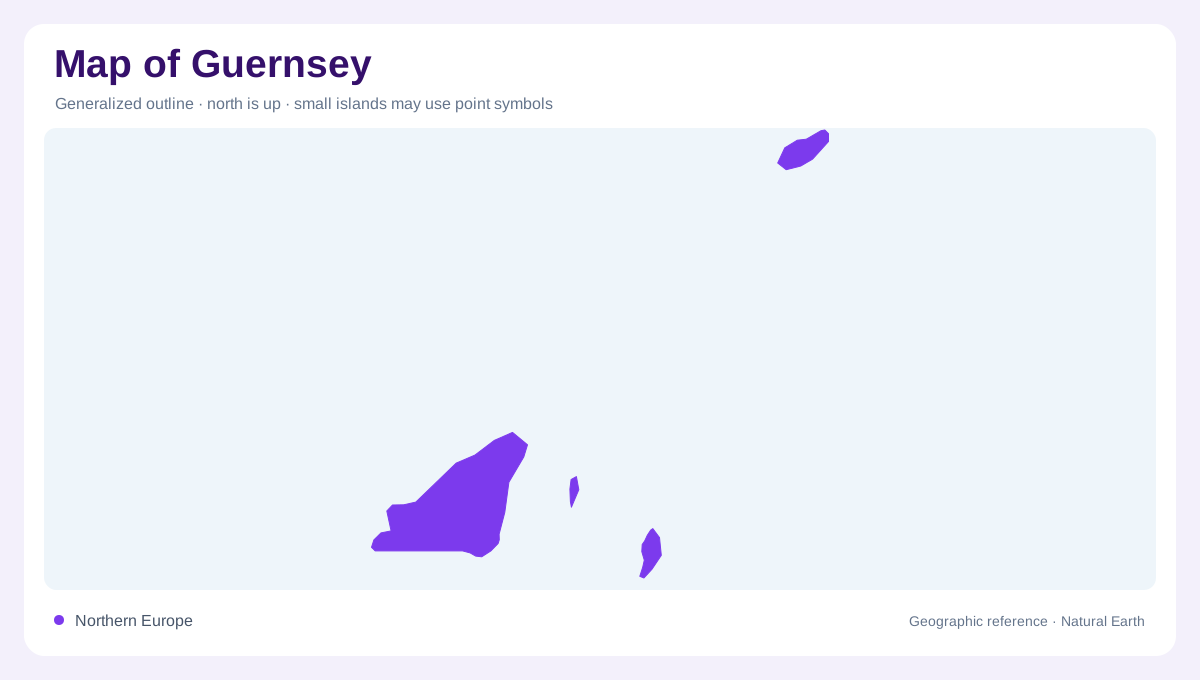
One island name, a wider group
Guernsey sits in the Channel Islands near the French coast, but the name also identifies a wider bailiwick containing other islands. Alderney, Sark, Herm and Lihou are therefore relevant to geographic coverage. They are separated by sea and should not be drawn as subdivisions on one continuous island. The main island remains the largest of this group, while Alderney provides a separate northern component. A regional view should preserve these relative positions before turning to town or coastal detail. Jersey belongs to the Channel Islands too, but it is a separate bailiwick and is not part of Guernsey's territorial unit.
Guernsey's contrasting coastal edges
The main island combines cliff landscapes, bays and lower shores rather than one repeated coastal form. Its west coast faces a different exposure from the eastern shore around St Peter Port. Cliff paths and tidal bathing places refer to different physical settings, even when represented by similar recreation symbols. A useful geographic map shows the coastline and inland relief before adding those labels. The shore's shape helps explain where sheltered water, projecting headlands and open coastal reaches occur. Reading Guernsey as a varied island surface also avoids treating the waterfront town as if it occupied the whole landmass.
St Peter Port and neighbouring Herm
St Peter Port provides the principal town reference on Guernsey's eastern side. Herm lies offshore across a separate stretch of water, with its own beaches and cliff edges. Their closeness makes them easy to associate, but Herm is not a peninsula or a neighbourhood connected by land. At small scale, narrow channels and tiny offshore shapes may merge visually. Keeping the sea gap legible is more important than enlarging every place label. A local coastal map can then show the relationship between the town's harbour setting and the surrounding islands without implying a particular transport service or continuous land route.
Sark and Alderney as distinct places
Sark has a defined island landscape of coastal cliffs and inland lanes, while Alderney combines its own beaches, coastal ground and settlement at St Anne. Their positions within the wider group require separate map coverage rather than a name appended to Guernsey's main island outline. Scale matters when comparing them: an enlarged Alderney inset can look similar in size to the principal island unless clearly labelled. Each island also contains its own short distances, shore orientations and relief. A shared administrative grouping does not remove those physical separations, and the sea between them is an essential part of their geographic relationship.
Lihou and a changing tidal margin
Lihou lies beside Guernsey and is associated with a tidal causeway, wetlands and rocky shore environments. Its connection changes with the tide, making a line on a map insufficient evidence of access at a particular time. This small island illustrates why coastlines need more than a single boundary stroke: intertidal ground can alternate between exposed and submerged conditions. Across the bailiwick, rocky margins, beaches and channels introduce similar distinctions at different scales. Reading Guernsey well means retaining both the principal island's coast and the wider scattered group, with island names attached to actual landforms rather than treated as interchangeable offshore labels.