An archipelago with two scales
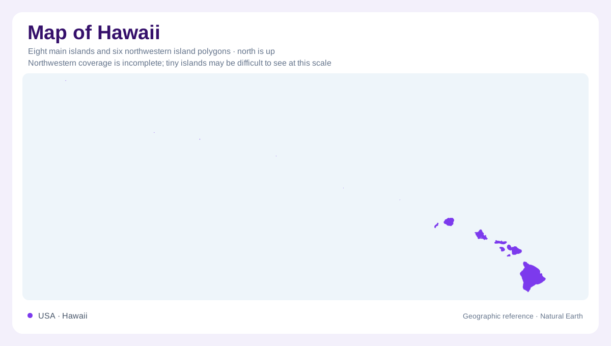
Hawaii requires an island perspective rather than a mainland one. Its principal islands occupy the southeastern end of a much longer chain extending northwest across the Pacific. Hawaii, Maui, Kahoolawe, Lanai, Molokai, Oahu, Kauai and Niihau account for nearly all the state's land area. Smaller islands, reefs and shoals extend the geographic story beyond this familiar group. The island named Hawaii is therefore only one part of the state bearing that name. An outline helps distinguish separate landmasses, but the ocean between them is essential to understanding their arrangement; nearby shapes do not represent connected districts of a single island.
Young volcanoes and older islands
The chain records volcanic construction as the Pacific Plate moved across the Hawaiian hotspot. Islands generally become older toward the northwest, while Hawaii anchors the younger southeastern end. Five volcanoes combine to form that largest island: Kohala, Mauna Kea, Hualalai, Mauna Loa and Kilauea. Mauna Kea and Mauna Loa dominate the island's heights. Their joined foundations explain why its coastline encloses several mountain systems rather than one central cone. At the wider Pacific scale, the islands are exposed summits within a much longer, mostly submerged volcanic chain. A state outline consequently captures only the land above water, leaving the great submarine foundations outside the visible geographic picture.
Different interiors within the chain
Island size alone does not describe terrain. Maui has elevated eastern and western parts separated by a broad lowland, giving its interior a different organization from Hawaii's combined volcanic masses. Molokai's higher mountains occupy its eastern half. Oahu has mountain belts on both its eastern and western sides, whereas Kauai's high ground lies more centrally. Niihau is comparatively low except for its northeastern ridge. These arrangements matter when interpreting coastal position: two places equally close to the sea can face very different inland barriers. Detailed elevation mapping reveals those contrasts more clearly than the perimeter of each island can.
Rainfall changes across ridges
Northeasterly trade winds carry moisture toward the islands. Rising air cools against mountain slopes, favoring rain on exposed windward terrain and leaving sheltered leeward districts drier. The relationship is not simply that every higher place receives more rain. Above the moist layer, a temperature inversion can limit upward airflow, and Hawaii's highest slopes can be comparatively dry. Lanai also receives less rainfall because larger neighboring islands shelter it. This creates a patchwork of water availability within a small geographic area. Coastal distance, slope direction and altitude must therefore be considered together when interpreting the islands' contrasting environments and vegetation.
Coastal settlement and inland watersheds
Honolulu occupies Oahu, rather than the state's largest island. Urban development across the principal islands commonly uses coastal lowlands, while extensive mountainous interiors constrain the space available for settlement and agriculture. Those uplands also help collect rainfall that sustains water resources below. Ocean influence moderates coastal temperatures, but it does not remove the effects of height: the tallest Hawaiian summits can experience freezing conditions despite tropical latitude. Reading the state geographically means keeping these overlapping contrasts in view: separate islands, differing mountain structures, windward and leeward slopes, and narrow inhabited lowlands beneath much higher land.