A small state at the head of the Gulf
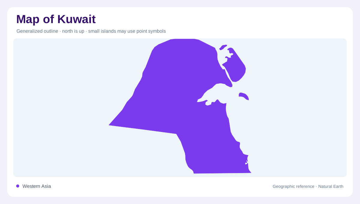
Kuwait occupies a coastal position near the head of the Persian Gulf, adjoining Iraq to the north and northwest and Saudi Arabia to the west and south. Its eastern side faces the sea. The outline encloses mainly desert plains, but the coast introduces bays, islands and tidal environments that deserve separate attention. Kuwait Bay creates an indentation in the maritime edge, with the urban area concentrated around its southern side and adjoining coast. A regional map should preserve that bay shape before adding dense settlement labels, because it is one of the physical features organising the country's coastal geography.
Gently sloping desert ground
The mainland is generally flat to gently undulating, with desert plains sloping broadly toward the northeast. This relief differs from the large mountain systems elsewhere around the Gulf. Small depressions and low rises still matter, however, for the movement of occasional surface water. A continental elevation map may suppress them entirely. Detailed contours reveal that the desert is not a perfectly level surface. Sandy soils also overlie layers with differing permeability, so the appearance of loose sand does not explain everything below ground. Rock and soil profiles add another dimension to a landscape that can look simple from above.
Waterways that appear after rain
Kuwait has no permanent rivers or natural freshwater lake network. Wadis and shallow depressions can carry runoff after rainfall, sometimes briefly and sometimes over several days. Their existence should not be confused with year round flowing streams. High evaporation and limited infiltration leave only a small contribution to groundwater recharge. A drainage map therefore describes potential pathways as much as continuously visible water. This distinction is central to reading the desert interior: branching channels can mark real landforms even when dry in an image, while a blue infrastructure line may represent transported water rather than a natural river basin.
Islands within the coastal frame
Bubiyan and Warbah occupy the northeastern coastal setting, while Failaka lies offshore near the entrance to Kuwait Bay. These islands are separate landforms, not detached fragments to be repositioned casually beside the mainland on a map. Their relationship to channels and shallow Gulf waters explains their setting better than their exposed area alone. Tidal margins can alter the visible boundary between wet and dry ground, around low islands. A complete country map should retain the island positions, while a coastal chart would distinguish surrounding depths and channels. Neither representation by itself establishes access, services or conditions at a particular time.
Groundwater beneath a dry surface
Sedimentary formations beneath Kuwait contain groundwater, with some lateral inflow arriving from Saudi Arabia. These underground systems are different from surface catchments and do not necessarily follow the same boundaries. Al Wafra near the southern border provides one inland reference associated with cultivated land, contrasting with the urban coastal picture. Water availability there should not be inferred from the absence or presence of a river symbol. Kuwait's physical structure is clearer when the layers are combined: gently sloping desert above, groundwater bearing formations below, and a Gulf frontage articulated by a bay and islands. The low relief conceals complexity rather than eliminating it.