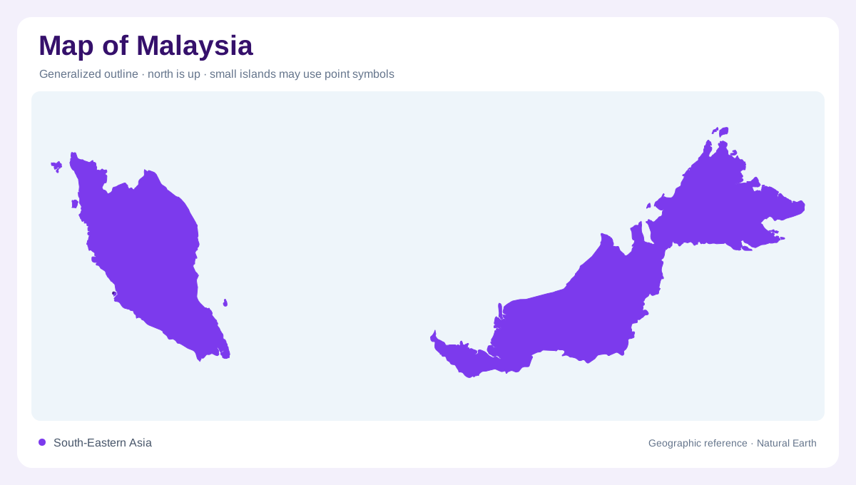
Two separated parts of Southeast Asia
Malaysia is not one continuous landmass. The FAO country profile divides it into Peninsular Malaysia, between Thailand and Singapore, and the eastern states of Sabah and Sarawak on the island of Borneo. That separation also changes the meaning of distance: an east coast on the peninsula is not the same as an east coast on Borneo on a national-scale map of Malaysia. The South China Sea separates these regions, so a national map needs an inset or a deliberately wide scale to keep their relationship clear. Peninsular Malaysia faces different coastlines on its west and east, while Sabah and Sarawak share Borneo’s larger interior geography. Read the maritime gap as part of the country’s outline, not as empty space between two interchangeable halves.
The Titiwangsa backbone
A mountain spine called the Banjaran Titiwangsa divides much of Peninsular Malaysia into western and eastern sides. The profile notes that a large share of the peninsula lies below 100 metres, especially across cultivable lowlands, but the central ridge interrupts that apparent flatness. Rivers descend toward both coasts, and the western side includes broad tidal flats and swamps where gradients are low. Lake Bera, a swamp lake in Pahang, is a useful inland reference. Relief, wetlands and coast should be read together to understand how the peninsula’s narrow width contains several physical zones.
Sabah and Sarawak on Borneo
Sabah and Sarawak occupy the Malaysian part of Borneo and should never be reduced to a coastal extension of the peninsula. Sabah’s interior is crossed by mountain ranges and hills, including the Crocker Range, with Mount Kinabalu as its highest point. Sarawak is generally mountainous, and its highest ranges form part of the border landscape with Indonesia. At national scale, these ranges appear as a broad interior block; at regional scale, valleys, headwaters and coastal plains become visible. The Borneo half of the map therefore carries a more expansive island context than Peninsular Malaysia.
Pahang, Rajang and coastal drainage
Malaysia’s rivers show how relief divides drainage. In the peninsula, the Pahang runs toward the South China Sea through the eastward-facing interior and is identified by FAO as the longest river there. Kelantan, Terengganu, Dungun, Endau and Sedili are additional east-coast rivers. In Sarawak, the Rajang is Malaysia’s longest river, crossing a much larger Bornean drainage setting before reaching the coast. A map that follows only state outlines misses these basin connections. River direction, catchment size and mountain position explain why the two national regions have different internal scales.
Monsoon weather and map interpretation
Malaysia lies in the equatorial zone, where the northeast and southwest monsoons alter the seasonal emphasis from coast to coast. FAO describes the northeast monsoon from October to March as especially wet on the peninsula’s east coast and in Sabah and Sarawak, while the southwest monsoon is generally drier. Rainfall is heavy overall, but altitude and exposure produce local differences. On a map, keep climate layers separate from permanent landforms: monsoon water can flood low plains without changing the location of a ridge, river mouth or island. Comparing peninsula and Borneo at matching scales reveals their shared climate and contrasting relief.