Three islands in the central Mediterranean
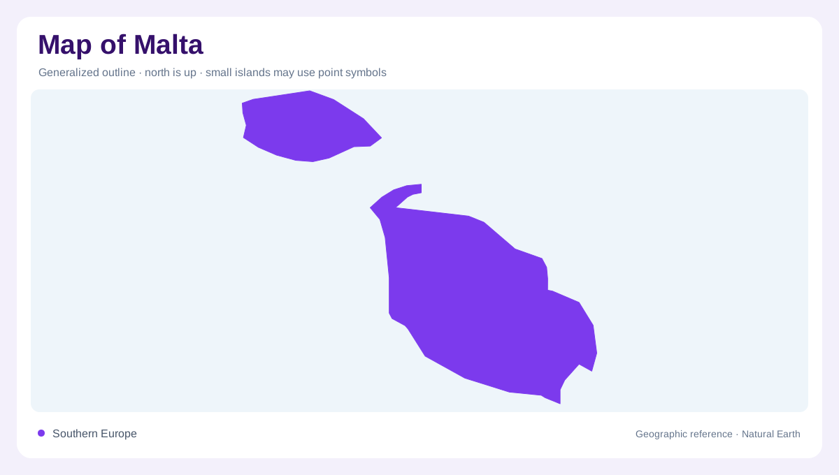
Malta is a central Mediterranean archipelago rather than one uninterrupted land unit. The official tourism profile places it about 93 kilometres south of Sicily and 288 kilometres north of Africa, and identifies three principal islands: Malta, Gozo and Comino. Malta is the largest and carries the archipelago’s main urban and administrative concentration; Gozo is smaller and more rural; Comino is the smallest and largely uninhabited. These components should be kept distinct on a map, even when a national inset presents them together.
Limestone coast and Gozo’s separate outline
Malta’s outline is compact but indented, with bays, headlands and natural harbours breaking a limestone coast. Inland, low plateaus, shallow valleys and stepped fields create more relief than the island’s modest elevation might suggest. Gozo has its own outline and internal pattern, separated from Malta by about five kilometres of sea. Its named features—Ramla l-Ħamra, Wied il-Għasri and the Qbajjar salt pans—help anchor a map of the smaller island without treating it as a northern peninsula of Malta. Across Malta, valleys often run inland from the coast and can become visual corridors between plateau settlements. The stepped fields and exposed rock make a contour map more informative than a simple altitude tint, especially where a harbour cuts into the island’s otherwise regular edge. A separate island frame keeps Gozo’s cliffs, coves and salt pans legible beside its own plateau and shoreline instead of flattening everything into Malta’s outline at once.
Comino and the sea channels
Comino occupies the channel between Malta and Gozo and should not disappear when the map is simplified. Its small scale and sparse settlement contrast with the much larger inhabited islands. Nearby islets and rocky points further complicate the coastline, so a regional chart is more useful for relationships while a detailed map is needed for coves and promontories. The archipelago’s central Mediterranean position also explains why sea distance, not road continuity, is the key relationship between its principal land areas. The separation also prevents the map from implying a continuous land corridor between the islands. Channels remain geographic features, not empty margins on a national diagram.
Freshwater in a dry island setting
Freshwater is a major geographic constraint. The FAO fact sheet records no surface-water withdrawal for Malta, alongside groundwater use and desalinated production. On the ground, this makes the distinction between a dry valley, a reservoir, a borehole and the surrounding sea important when interpreting symbols. Rainfall may collect briefly in channels without creating a permanent river network. A water map therefore tells a story of limited natural storage and engineered supply rather than broad perennial drainage.
Reading the archipelago at two scales
At overview scale, place Malta near Sicily and show Gozo and Comino with enough separation to preserve their island identities. At island scale, read Malta’s harbours and valleys as coastal openings in a low limestone landscape, then switch to Gozo’s smaller rural pattern and Comino’s largely unbuilt surface. The limestone land surface connects terraces and valleys within each island, while marine channels interrupt those relationships between islands. Groundwater and desalinated supply belong to another layer, explaining freshwater availability across densely occupied land surrounded by the Mediterranean.