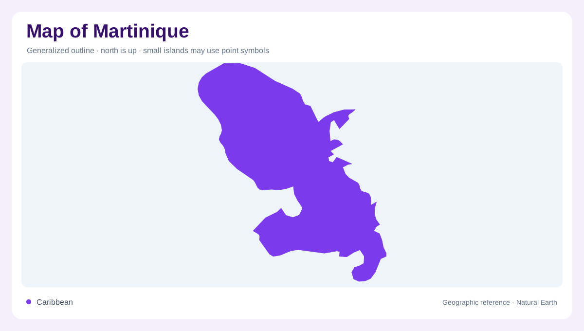
One island with contrasting coasts
Martinique is a single mountainous island in the eastern Caribbean, but its outline is best understood through three contrasting regions: a wetter volcanic north, a central zone around Fort-de-France Bay, and a more open southern coast. The island’s eastern shore faces the Atlantic, while the western shore opens toward the Caribbean Sea. This dual-coast setting matters on a map because bays, capes and prevailing exposure change noticeably around the island rather than following one simple shoreline pattern. The central area is not merely a midpoint: it gathers lowland and bay geography between the volcanic north and the peninsulas of the south. When the island is reduced to a small regional symbol, that internal hinge can vanish, so a relief map should retain the north–south spine.
Mount Pelée and the northern slopes
Mount Pelée dominates the north. Martinique Tourisme gives the volcano an altitude of 1,397 metres, making it the island’s highest point. Slopes around the massif feed a landscape of rainforest, rivers, waterfalls and black-sand beaches. Saint-Pierre sits on the coast below the mountain, so the relationship between volcanic high ground and the bay is easy to see at regional scale. The northern map should therefore be shaded for relief, not represented as an undifferentiated green block. The mountain also divides visual drainage patterns: short rivers descend toward different coasts, and the northern highlands occupy more of the island’s vertical profile than the beaches do.
The Caravelle Atlantic projection
On the Atlantic side, the Caravelle Peninsula projects into the sea and forms a distinctive eastern landmark. The tourism authority describes it as a protected nature reserve with varied plant and animal life. Its narrow projection, coves and surrounding shallows make it useful for orienting the north-east coast. Farther inland, river gorges such as the Gorges de la Falaise show how short, steep drainage courses can cut through volcanic terrain before reaching the coast. The projection marks a transition from the mountain-dominated north toward a broken coast, and its position separates Atlantic features from the central bay on regional maps too.
Southern bays and volcanic remnants
South Martinique has a different visual vocabulary: bays, beaches, low coastal promontories and the dry-looking terrain around the Savane des Pétrifications. Grande Anse, Anse Noire and Anse Dufour are named coastal reference points near Les Anses-d’Arlet. Offshore, Diamond Rock is described by Martinique Tourisme as a remnant of volcanic activity. It should be drawn as a separate maritime feature, not folded into the main island’s southern outline. Those southern features are not interchangeable: a sandy beach, volcanic rock and a protected dryland trail each describes a different part of the coastal mosaic.
A layered reading of the island
Fort-de-France and the central basin provide the island’s main orientation hinge, but they do not erase the regional contrasts. Use the north–south axis to connect Mount Pelée with the southern peninsulas, then use the east–west coast names to locate bays and Atlantic projections. A detailed map can show islets, gorges and headlands; a wider Caribbean view supplies the island’s position among the Lesser Antilles. This layered reading keeps volcanic relief, drainage and coastal shape in the same frame.