An eastward turn toward the Atlantic
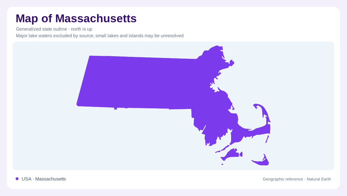
Massachusetts stretches across southern New England, with its broad inland body narrowing into a complicated Atlantic coastline. Sandy Cape Cod curls away from the mainland, while Martha's Vineyard and Nantucket occupy separate positions south of Cape Cod. These extensions make the state's geography less rectangular than its western boundaries suggest. Boston belongs to the eastern coastal setting; the Connecticut River valley introduces a different organizing line farther west. An outline establishes the relationship between mainland, peninsula and islands, but does not explain their elevations. That distinction matters here because a short inland distance can connect coastal lowlands with considerably hillier country.
Cape Cod is a deposit in motion
Glacial material supplies the foundation of Cape Cod. Sand, gravel, silt, clay and boulders accumulated during the ice age, leaving a landscape whose surface differs from the exposed rock of many New England uplands. Retreating ice established the basic shape; waves, wind and flowing water continued the work. The outer Cape therefore combines an inherited glacial framework with an actively changing shore. Bluffs lose sediment, beaches receive and redistribute it, and dunes respond to wind. A coastline traced at state scale cannot capture those exchanges. Even apparently familiar curves represent a particular stage in a much longer coastal process.
A watershed crossing state lines
The Connecticut River links Massachusetts with New Hampshire, Vermont and Connecticut through one watershed. Within Massachusetts, its valley includes islands, floodplain woods and tributary wetlands rather than a single uniform strip. Third Island at Deerfield illustrates the river's small wooded islands, while the Fort River at Hadley drains part of the eastern Pioneer Valley. The Mill River refuge division in Northampton protects another floodplain setting. These places help distinguish the main river from the smaller catchments feeding it. Water arriving from outside Massachusetts also makes clear why the state boundary is a political limit, not the edge of a drainage system.
Ridges beside the valley
Low ground and upland can stand remarkably close together along the Connecticut corridor. Mount Tom near Easthampton belongs to the Metacomet Range, whose origins involve volcanic activity followed by later deformation and erosion. Exposed traprock and steep wooded slopes contrast with nearby floodplain environments. This local relief complicates any simple division between a flat east and mountainous west. Massachusetts does broadly become higher and hillier inland, but its river valleys interrupt that progression. Reading the landscape requires both directions: an east to west comparison across the state and a closer view of the ridges rising beside individual valley floors.
Distance from the sea changes the setting
The Atlantic moderates coastal temperatures, while inland terrain experiences more continental conditions. Western Massachusetts generally has cooler summers, and winter temperatures differ more sharply between the interior and coast. Forest covers much of the state, so metropolitan Massachusetts should not be mistaken for the entire landscape. The peninsula, islands, river corridor and western hills each provide a different geographic frame. Together they explain why statewide orientation and local landform interpretation are separate tasks. Cape Cod calls for attention to mobile sediment; the Connecticut valley calls for attention to tributaries and floodplains; the uplands require close attention to differences in height.