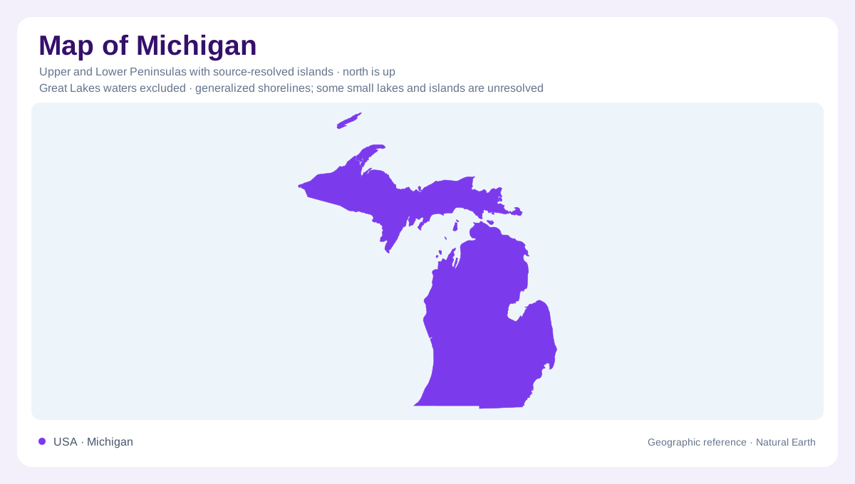
Two peninsulas make one state
Michigan requires a different starting point from most state maps: its land is divided into two large peninsulas. The Lower Peninsula projects between Lakes Michigan and Huron, with Lake Erie touching its southeastern edge. The Upper Peninsula lies south of Lake Superior, with Lakes Michigan and Huron along its southern and eastern sides. Water therefore organizes the state's shape more strongly than a simple rectangular boundary. The narrow separation at the Straits of Mackinac connects the lake basins while dividing the land. Recognizing both peninsulas prevents the familiar mitten shape from becoming an incomplete mental picture of Michigan.
Shorelines change the temperature pattern
The Great Lakes influence nearby land as well as its outline. Their waters moderate temperature, helping shore communities remain cooler in summer and warmer in winter than inland places at similar latitudes. Muskegon and Lansing illustrate that distinction: the former is beside Lake Michigan, while the latter occupies the Lower Peninsula's interior. Lake Superior produces an especially strong contrast around the Upper Peninsula. Latitude alone consequently cannot explain Michigan's local climate. Distance from open water and position relative to an individual lake also matter. A shore and an inland location can share a latitude without sharing the same temperature extremes.
Sandstone above Lake Superior
Pictured Rocks provides a precise example of the Upper Peninsula's varied shore. Near Munising, sandstone cliffs rise directly above Lake Superior, while farther east the national lakeshore includes beaches and dunes. The cliffs record ancient sediment deposition, long before the glaciers that later covered the region. Several rock formations are stacked together, with different resistance to erosion. Harder layers help maintain ledges; weaker ones wear away more readily. The result is a shoreline containing arches, caves and projecting rock forms. These are local features of a particular coast, not a description of every mile surrounding Michigan's two peninsulas.
Color, groundwater and moving sand
The colors at Pictured Rocks are evidence of water moving through rock. Groundwater seeps from cracks and leaves distinctive mineral stains across the cliff faces, including iron producing red and orange tones. Lake waves, winter ice and weather then work on the exposed stone. At Grand Sable Dunes, the material and process differ: shifting sand rests above a bluff of glacial debris. Bedrock erosion and dune movement can occur within the same protected shoreline while producing very different landforms. A geological comparison therefore adds information that a coastal outline cannot supply, distinguishing rock layers, deposits left by ice and sediment redistributed more recently.
Keeping land and lake scales separate
Michigan's water boundaries can make distances deceptive. A place across a bay may be close in a straight line but separated by a substantial expanse of water. The long Upper Peninsula also extends far beyond the northern tip of the Lower Peninsula. For geographic orientation, first identify the peninsula, then the adjacent lake, and finally whether the location is coastal or inland. That sequence distinguishes a Lake Superior cliff setting from central Lower Peninsula country without assuming that the outline contains terrain information. Michigan combines connected freshwater basins with divided land, and both relationships deserve equal attention when interpreting its shape.