An archipelago east of Australia
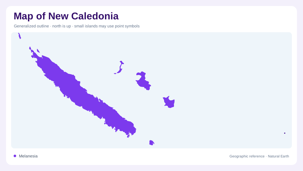
New Caledonia is a Melanesian archipelago in the southwest Pacific, east of Australia and north of New Zealand. Its main landmass, Grande Terre, is a long, narrow island running roughly northwest to southeast. Smaller components change the map’s scale: the Loyalty Islands lie east, Île des Pins stands south, and the Belep Islands sit near the northern tip. These are not decorative offshore specks. Their separation by open water affects coastlines, relief, settlement and navigation. A regional map should show the island group together, while a detailed map must keep each island’s orientation and individual shape visible across the Pacific.
The spine of Grande Terre
Grande Terre measures about 400 kilometres from end to end but is 50 kilometres wide in many places. A central mountain chain follows its length, dividing the island into contrasting eastern and western faces. The west presents broader plains and savanna-like lowlands around bays; the east is generally narrower, wetter and more abruptly mountainous. The range is not a single straight wall, so passes, valleys and coastal shelves interrupt its continuity. On shaded relief, compare the long axis with the coast rather than assuming that the island’s narrowness means uniform terrain. Local basins can be hidden within the elongated outline.
Rivers, mangroves and lagoon water
Water follows the relief toward several coasts. Short rivers descend from the central chain, with larger lowland valleys opening across the west and more confined channels reaching the east. Mangrove margins occur where sediment and tidal water meet, especially around sheltered bays and estuaries. The surrounding lagoon adds a second drainage-like pattern: reef passages, shoals and enclosed waters encircle much of Grande Terre, yet they are marine rather than inland lakes. A map reader should separate river mouths from lagoon channels, then distinguish the barrier reef from the island shoreline. Those layers explain why the oceanic outline appears unusually intricate.
Coral islands and red southern ground
The archipelago’s geology becomes legible through colour and texture. The southern part of Grande Terre is known for lateritic red ground, contrasting with darker forested slopes and distinct mineral plateaus nearby. Other sectors contain sedimentary and volcanic formations, while the Loyalty Islands are raised coral islands with broad limestone surfaces and distinctive cliffs. Île des Pins has its own smaller-island relief and coastal shape. These components should not be generalized from the main island. Comparing rock, vegetation and elevation helps explain why dry woodland, humid forest, mineral plateaus and coral coasts occur within a relatively compact Pacific archipelago on maps.
Settlement beside the reef
Nouméa and the nearby southwestern conurbation form the clearest concentration of settlement, while communities elsewhere align with coastal plains, valleys and island shores. The archipelago includes more than 140 islands, so Nouméa’s urban shoreline represents only one of many coastal settings. Lifou’s limestone cliffs, for example, have a very different geological character. Its lagoon is a vast regional feature, bounded by reefs that organize the maritime map. At broad scale, retain Australia, Vanuatu and the wider Melanesian setting and the surrounding southwestern Pacific waters; at local scale, read each island’s reef, ridge, bay and plain as a separate geographic story.