A geographic label on a divided island
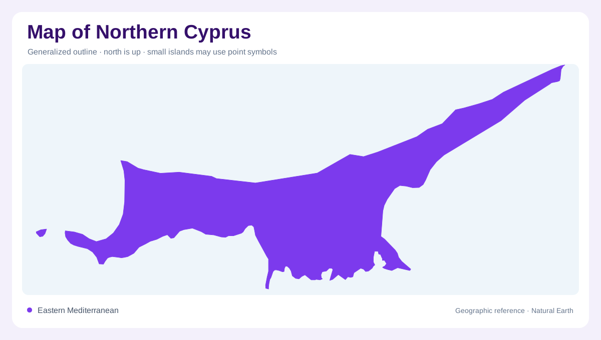
Northern Cyprus occupies the northern portion of a divided Mediterranean island. The Green Line separates the island’s two sides; the self-declared Turkish Republic of Northern Cyprus is not recognized by the United Kingdom. Physical geography crosses this political division. On a map of the island, the northern coastline faces the eastern Mediterranean while the Kyrenia or Besparmak Mountains form a long interior edge. Behind that ridge lies the Mesarya plain, with Nicosia near the island’s central zone and Famagusta farther east. The outline is easiest to understand as a narrow coastal strip, a mountain barrier, and an eastern peninsula.
The Kyrenia mountain barrier
The Besparmak Mountains, also called the Kyrenia Mountains, run for more than 170 kilometres parallel to the northern coast. Visit North Cyprus describes a limestone range containing dolomite and marble, with Selvili Tepe rising just above 1,000 metres. Its narrow, abruptly lifted form is more important than its maximum height: the range separates the northern shore from the Mesarya plain and shapes the island’s wind, water, and settlement pattern. Passes cut through the ridge, while porous limestone stores groundwater. On a relief map, this continuous barrier explains why nearby coastal and inland places can occupy contrasting terrain.
Western plains and foothills
West of Nicosia, Güzelyurt and Lefke occupy a different landscape from the steep northern escarpment. The official tourism profile places Güzelyurt near the foothills of the Troodos Mountains and describes the surrounding area as a fertile agricultural plain with citrus and other crops. Lefke’s profile adds mountain springs, lakes, reservoirs, and a rich coastal plain. These details matter on a map because western Cyprus is not simply an extension of the Kyrenia shore. The plain, foothills, and sea-facing settlements form a broad western compartment whose boundaries are easier to see with relief and drainage symbols. Seasonal drainage lines descending from the foothills help explain why western agriculture clusters on the low plain while the adjoining limestone slopes remain visually open on detailed maps.
Famagusta and the Karpaz peninsula
To the east, Famagusta anchors a coastal setting historically associated with a naturally deep harbour, while the Karpaz Peninsula projects far into the Mediterranean beyond İskele. Visit North Cyprus describes Karpaz as almost 80 kilometres long, with rolling hills, maquis, cypress and pine vegetation, and nesting grounds used by sea turtles. The peninsula should remain distinct from the central plain: its long taper, irregular shores, and sparse interior create a different map pattern. Salamis provides an additional eastern reference point, separate from the modern harbour and town.
Reading towns and physical boundaries
Kyrenia, Nicosia, Famagusta, Güzelyurt, Lefke, and İskele are useful anchors, but their labels should not imply one continuous urban area. Kyrenia sits between a coastal port and the mountain face; Nicosia occupies the central plain; Famagusta and İskele relate to the eastern coast and Karpaz approach; Güzelyurt and Lefke face western lowlands. A map should also distinguish beaches, agricultural ground, limestone ridges, reservoirs, and open sea. The disputed political boundary is not a landform. Keeping that distinction visible allows the geographic record to remain precise without turning a contested status into a cartographic conclusion.