Mainland and island regions
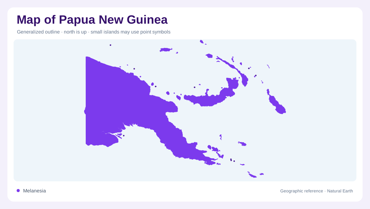
Papua New Guinea combines the eastern portion of New Guinea with extensive offshore islands. The mainland outline alone therefore gives an incomplete picture. The national tourism authority groups destinations into Highlands, Momase, Papua, and Islands regions, a useful starting framework for geographic reading. These broad divisions separate inland mountain country from coastal provinces and island groups without suggesting that each region has uniform terrain. First identify the main island and its border with Indonesia, then find the islands to the northeast and east. This establishes the country's dispersed shape before individual towns or provincial boundaries begin to dominate the view.
An inhabited mountain interior
The Highlands are a landscape of elevated valleys, ridges, forest, and cultivated ground. They include Eastern Highlands, Enga, Simbu, Southern Highlands, Western Highlands, Hela, and Jiwaka provinces. Goroka, Mount Hagen, Tari, Kundiawa, Wabag, and Mendi provide named anchors across this interior. Their distribution challenges any assumption that settlement is confined to the coast. Valley floors can support communities and agriculture while nearby ridges divide neighboring areas sharply. A shaded relief map explains this pattern more clearly than provincial colors alone. Highland coffee areas around Goroka add another geographic layer, connecting cultivated landscapes with the elevation of the interior.
Summits and local relief
Mount Wilhelm in Simbu reaches 4,509 metres, placing the country's highest summit within the inhabited highland interior. Mount Giluwe, associated with the Southern Highlands, introduces steep volcanic terrain at another elevated landmark. Their slopes belong to landscapes containing waterfalls, forest reserves, agricultural valleys, and coffee ground. Altitude helps distinguish this region from the coastal lowlands: cooler highland conditions accompany the rise from sea level. Yet the mountains are not simply an empty band between northern and southern settlements. The named towns and cultivated valleys occupy the same interior that contains these summits, with substantial changes in relief.
Sepik waters and contrasting shores
The Sepik River organizes a northern mainland landscape of river communities and rainforest. Wewak, near Muschu and Kairiru, is a coastal center in East Sepik, while Madang's shore combines lagoons, coral reefs, and offshore islands. Farther east, Lae faces the Huon Gulf in Morobe. These distinct water settings belong to Momase, stretching along the northern coast toward the Indonesian border. Across the mountainous mainland, Port Moresby occupies a southern coastal setting. Milne Bay draws attention to the eastern extremity, where islands extend beyond the mainland. Rivers, reefs, and gulfs thus provide geographic anchors that administrative colors alone cannot convey, particularly where coast and interior meet.
The offshore country
The Islands region includes East and West New Britain, New Ireland, Manus, and the Autonomous Region of Bougainville. These entries represent separate places across substantial water spaces, not suburbs of a mainland center. New Britain's two provincial names refer to parts of one island, whereas New Ireland identifies another major island. Bougainville requires its own geographic attention within the eastern island distribution. When maps use inset panels, compare their scale bars before interpreting apparent proximity. Keeping the mainland provinces and offshore regions in the same account gives Papua New Guinea its proper breadth: mountains, coastal margins, and multiple island landscapes.