Mainland Portugal on the Atlantic edge
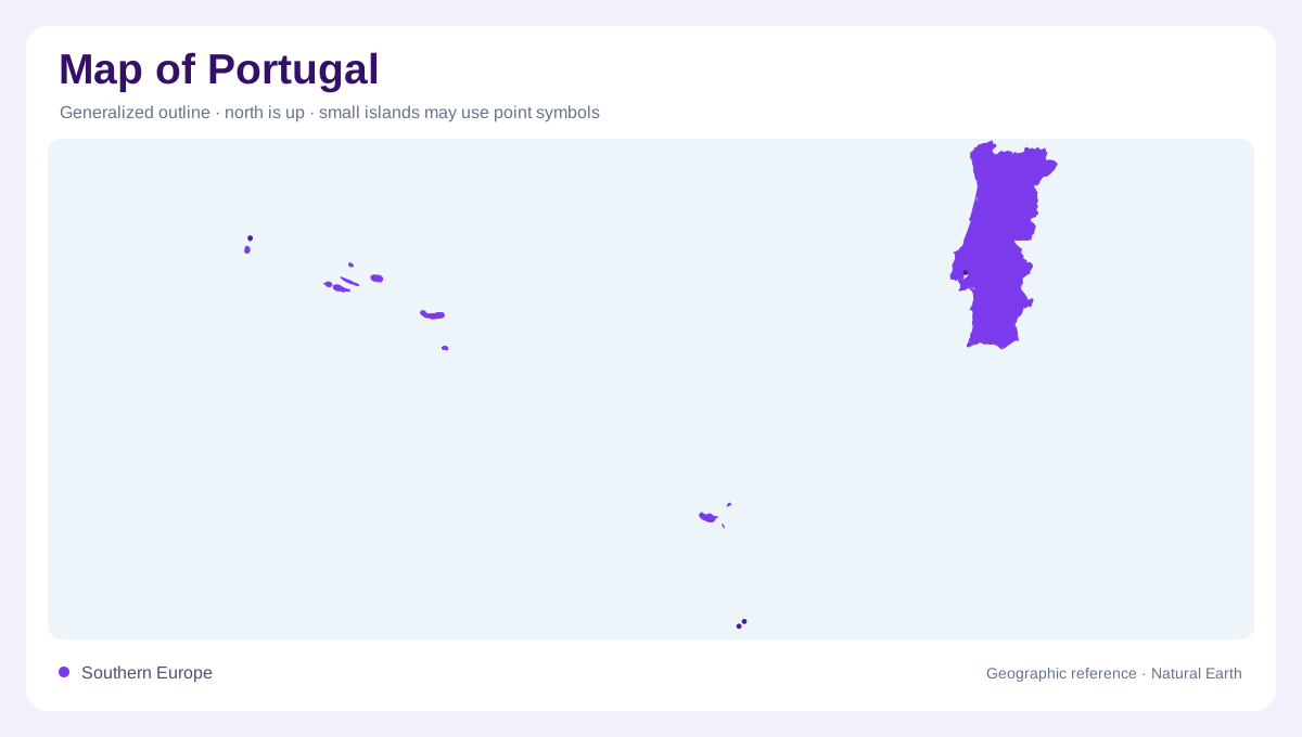
Portugal has a long Atlantic-facing mainland on the western side of the Iberian Peninsula, with Spain forming its northern and eastern land boundary. Its outline narrows and widens through river valleys, estuaries, capes, and coastal plains rather than following a simple rectangle. Porto sits near the Douro estuary in the north, Lisbon occupies the broad Tagus estuary farther south, and the Algarve forms the mainland’s southern coastal region. Begin with the mainland before adding the Atlantic archipelagos; otherwise the separated island territories can distort the country’s scale and north-to-south structure.
Rivers, uplands, and southern plains
The Douro, Tagus, and Guadiana are major mainland river references, each creating a different relationship between interior terrain and the Atlantic. Northern Portugal is more dissected by valleys and uplands, including the Douro landscape, while central areas rise toward the Serra da Estrela. South of the Tagus, the Alentejo opens into broader plains before the Algarve’s hills and coast. Relief shading helps distinguish a valley floor from a plateau, while estuary symbols explain why Lisbon and Porto occupy especially legible positions on a national map. Watercourses and elevation together organize the mainland better than provincial boundaries alone.
The nine islands of the Azores
The Azores form a separate mid-Atlantic archipelago of nine islands: Santa Maria, São Miguel, Terceira, Graciosa, São Jorge, Pico, Faial, Flores, and Corvo. The official Visit Azores portal presents them as distinct island destinations, and their spacing matters more than their small printed silhouettes. Volcanic cones, crater lakes, steep coastal slopes, and narrow cultivated strips give the islands strong internal relief. São Miguel and Terceira are not substitutes for the entire group; Flores, Corvo, and the other islands occupy separate ocean positions. An inset should preserve those gaps instead of compressing them into a single symbol.
Madeira and Porto Santo
Farther southeast in the Atlantic, the Madeira archipelago adds a distinct island setting. Madeira is mountainous, deeply incised, and strongly organized by north and south coasts; Funchal lies on the more developed southern shore. Porto Santo is a separate, smaller island with a lower and drier appearance, while the Desertas and Selvagens are smaller protected island groups. The official Madeira tourism board treats Madeira and Porto Santo as separate destinations, and the regional conservation institute records the Desertas and Selvagens reserves. Relief, cliffs, reefs, and offshore separation are essential map clues here.
One country at several scales
Portugal is easiest to read through three linked scales: the mainland along Iberia, the nine-island Azores chain, and the Madeira–Porto Santo group. Lisbon, Porto, Faro, Funchal, and Ponta Delgada provide orientation points, but each belongs to a different coastal or island landscape. A continental overview establishes Atlantic position and Spanish adjacency; regional panels reveal river basins, mountain ridges, volcanic interiors, and shore forms. Keep the archipelagos in separate insets with independent scale bars. Their physical distance from the mainland is part of Portugal’s geography, not a cartographic inconvenience to be hidden. An island’s apparent closeness on a page can therefore conceal a long ocean interval, while a detailed inset can make rugged relief visible without implying mainland continuity or a shared coastal plain between them.