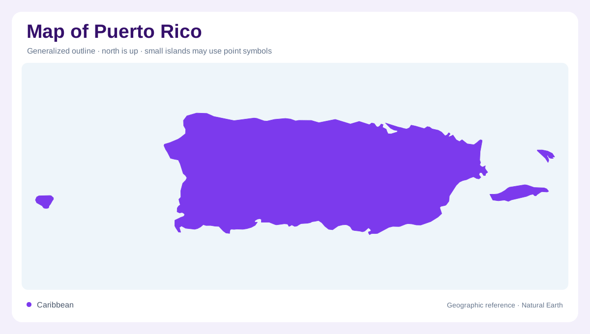
An eastern Caribbean main island
Puerto Rico sits in the eastern Caribbean as the smallest of the Greater Antilles, with a rectangular main island and a nearby chain of cays and islands. Its long axis runs west to east, so a map is easier to read when the central island is separated from offshore municipalities of Vieques and Culebra. San Juan anchors the northeast coast, while Ponce faces the drier south and Mayagüez marks the west. The Mona Passage separates its western shore from Hispaniola's eastern island coastline. Treat the surrounding Atlantic, Caribbean Sea, Mona Passage and Vieques Sound as essential spaces, not blank margins.
The Cordillera Central backbone
More than half of the main island is mountainous, and Cordillera Central forms the organising backbone. Cerro Punta, between Jayuya and Ponce, is the highest point, while subsidiary ridges send short slopes toward every coast. The northward descent is interrupted by limestone karst, caves and mogotes; the southern foothills open more gradually toward dry coastal plains. El Yunque occupies the humid northeast mountains, distinct from the central highlands even though both rise above nearby towns. On a relief map, the narrow waist of Puerto Rico becomes a meeting place of ridges, passes and valleys rather than a flat Caribbean rectangle.
Rivers and unequal rainfall
Watercourses are numerous despite the island's compact size: the GIS description records about eight hundred streams. Northern rivers generally carry more water, reflecting the mountain alignment and moist northeast trade winds, while the south is warmer and drier. The Río de la Plata, Río Grande de Loíza and Río Grande de Arecibo illustrate how drainage gathers from uplands before reaching the north coast. The Río Grande de Añasco runs westward, whereas southern rivers are shorter and more seasonal. Because watersheds cross municipal lines, follow ridges and stream mouths together when interpreting boundaries, reservoirs and cultivated valleys on a detailed map.
Vieques, Culebra and Mona
Vieques lies east of the main island across a broad channel, and Culebra sits farther northeast near the Virgin Islands. These are substantial inhabited islands, not decorative dots, and their coves, hills and settlement clusters deserve separate scale. Mona, between Puerto Rico and Hispaniola, is more isolated and should not be folded into the urban pattern of San Juan or Ponce. Smaller islets fringe reefs, bays and headlands, especially along the south and west. A locator map may compress these pieces, so use an inset or nautical spacing before judging distance, alignment or the apparent continuity of Puerto Rico's coastline.
Reading geography at two scales
At regional scale, San Juan's metropolitan plain contrasts with the forested interior and the coastal lowlands around Arecibo, Aguadilla, Mayagüez, Ponce and Guayama. Scale changes the story. At local scale, karst ridges, river mouths, reservoirs and mangrove or wetland edges matter more than broad municipal labels. Official map layers distinguish hydrography, geology, topography, wetlands and legal boundaries, which should not be treated as interchangeable. El Yunque's forest reserve is one focused highland landscape within a much larger island system. Read the article's map as a geographic reference: it explains landforms and relationships, not live directions, access permission or current conditions.