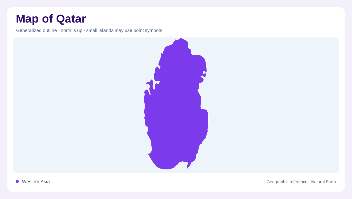
A peninsula in the Arabian Gulf
Qatar is a peninsula projecting north into the Arabian Gulf, with Saudi Arabia connected along its southern land border and water surrounding other sides. The geography page gives an area of 11,437 square kilometres and a land border of 87 kilometres. A narrow strait separates Qatar and Bahrain to the west, so the outline belongs to a maritime setting rather than an inland desert block. Doha occupies the eastern side of the peninsula and provides an orientation point, but it should not stand for the whole country. On a map, the northward taper and extensive shoreline are the first clues.
Low limestone and shifting dunes
The interior is low and arid, yet its surfaces are not uniform. Qatar Tourism distinguishes sandy dunes around Khor Al Adaid from rocky hamada, the weathered limestone desert that covers much of the peninsula. Crescent-shaped dunes gather where wind shapes sloping plains, while jebels are fossilised limestone dunes rising as landforms. Qurain Abu al-Bawl in the south reaches 103 metres, a prominent southern elevation reference, only modestly above sea level. This low relief explains why broad maps can appear almost blank. Zooming in reveals pale limestone, gravel, salt crusts, shallow depressions and small ridges that organize local drainage and tracks.
Bays, sabkhas and the Inland Sea
Qatar's coastline stretches about 563 kilometres and bends into bays, coves, tidal flats and beaches. The eastern shore faces the open Gulf, while the north and west contain more intricate inlets and offshore features. Khor Al Adaid, the Inland Sea, is a southeastern landscape where sand, salt water and dunes meet. Sabkhas occupy low ground touched by seawater, producing bright salt-encrusted flats that can be mistaken for dry lake beds. Because the shore is highly indented, a straight-line distance between two coastal places may be much shorter than the route around an inlet. Shoreline symbols deserve a careful scale check.
Islands and briny ecosystems
Offshore islands help explain the peninsula's ecological variety. The geography page mentions ten islands, including Al Safliya, Al Aaliya and Purple Island, while Qatar's nature material identifies mangroves around Purple Island and Al Thakhira. Briny water, changing tides and shallow coastal ground create habitats for fish, gastropods and birds. Coral reefs are associated with the northeastern coast and waters around Al Aaliya Island. These features are not interchangeable: an island, reef, mangrove stand and tidal mudflat may appear close together but represent different layers. Use a coastal chart to keep land above water separate from submerged or seasonally flooded environments.
Settlements across a waterless desert
Settlement follows the coast and coastal lowlands more strongly than it follows elevation. Doha is the dominant urban reference, while Al Khor, Dukhan and Madinat ash Shamal help locate northern and western sectors. The absence of permanent rivers means that wadis and runnels, rather than perennial channels, explain occasional green lines and flash-flood pathways. At broad national scale, distinguish the peninsula, Saudi land border, Gulf waters and islands. At local scale, read hamada, dunes, sabkhas, mangrove margins and urban reclamation separately. This reference map describes stable physical relationships; it does not promise access, navigation, tides, traffic or current coastal conditions.