From Atlantic frontage to basin
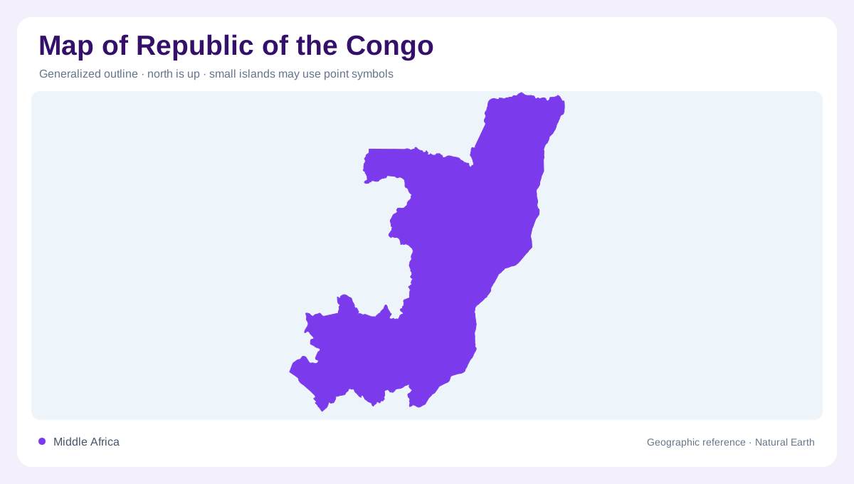
The Republic of the Congo occupies a west-central African corridor from a short Atlantic frontage inland to the Congo Basin. Gabon borders the west and northwest, the Democratic Republic of the Congo lies across much of the eastern and southern river boundary, and Angola's Cabinda lies immediately southwest. Pointe-Noire marks the ocean-facing end, while Brazzaville stands inland on the Congo River at Pool Malebo, opposite Kinshasa. This paired-capital setting is a crucial map clue: the two cities face one another across water, yet belong to different states. Keep the country distinct from its similarly named neighbour when reading regional maps.
Coastal plains and rising plateaus
Relief changes in bands rather than a continuous mountain wall. Low coastal plains give way to the Mayombe uplands, then to valleys and plateaus farther inland. The Niari valley forms a broad southern corridor between higher ground, while the Bateke Plateau rises northeast of Brazzaville toward the interior basin. These landforms explain why the narrow Atlantic edge does not describe the whole country. Shaded-relief maps should be read from sea to plateau, then onward toward the flatter northern basin. Elevation also helps separate the settled coastal and river corridors from forested or seasonally flooded spaces that occupy much larger areas.
Pool Malebo and the Congo drainage
The Congo River is the dominant eastern reference. At Brazzaville, it widens into Pool Malebo before continuing toward the Atlantic, and the channel helps define a long international boundary with the Democratic Republic of the Congo. North of the pool, the Sangha and Likouala systems drain through the Cuvette Congolaise and its tributary wetlands, a basin of marshes, floodplains and gallery forests. The Ubangi joins the wider Congo drainage farther north and east. River lines therefore describe more than transport or settlement: they reveal connected wetlands and a continental basin whose waters cross several national outlines before reaching the ocean.
Rainforest departments and wetlands
Rainforest dominates the northern and central interior, with the Embassy of the Republic of the Congo describing roughly seventy percent of national territory as forested. The Sangha Department and Likouala are useful labels for locating this broad forested green zone, while Cuvette and Cuvette-Ouest indicate basin country around rivers and wetlands. Forest cover is not an unbroken texture: clearings, savanna patches, villages and channels interrupt it, and seasonal water changes the visible boundary locally. Protected landscapes such as the northern Sangha forests should be read as ecological regions within a national outline, not as separate countries or invented urban districts.
Reading a spacious, river-shaped country
At national scale, compare three axes: Atlantic coast, Congo River frontage and interior basin. Pointe-Noire and Brazzaville are strong orientation anchors, but most of the map's land area lies beyond those metropolitan references. Department capitals such as Ouesso, Impfondo, Owando and Djambala help locate regional centres without implying continuous settlement between them. On a detailed map, inspect tributaries, floodplain edges, plateau breaks and coastal lagoons separately. Brazzaville's river frontage and Pointe-Noire's Atlantic shore occupy different ends of the southern corridor, with Mayombe uplands rising between them. This guide explains terrain, drainage and settlement patterns, not access, security or current infrastructure.