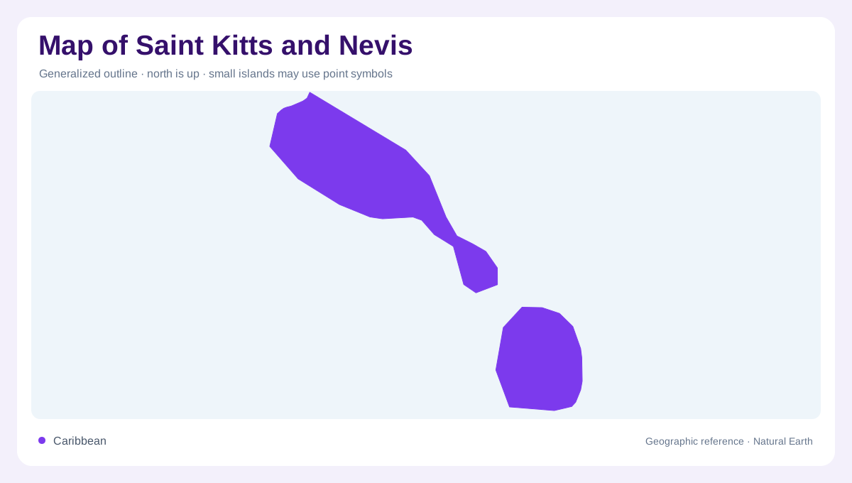
Two islands divided by The Narrows
Saint Kitts and Nevis is a two-island Caribbean state; keep the islands separate on a map. St Kitts is 69 square miles; Nevis covers 36 square miles southeast across The Narrows. The Caribbean lies west and the Atlantic east, with central highlands providing the strongest relief. Both islands place their highest summit near the middle, not along the shore, and most settlement occupies lower coastal belts. A regional map therefore shows a paired volcanic system: one elongated island with a projecting southeast peninsula and one more compact volcanic cone, divided by a short but decisive water gap.
St Kitts rises around Mount Liamuiga
Mount Liamuiga is St Kitts's highest point, reaching 1,156 metres in central volcanic highlands. Tropical rainforest surrounds the summit zone, and the government describes these uplands as mostly uninhabited. That pattern creates a useful contrast on a map: Basseterre and other communities occupy the lower coastal perimeter, while the interior is read through ridges, valleys, and shaded slopes rather than a dense town network. The island's outline then narrows toward the southeast, where lower ground and a long peninsula extend away from the main mountain mass. Coastline distance can be misleading here because the relief separates nearby bays and settlements.
Nevis Peak and the compact island cone
Nevis is smaller but not flatter. Nevis Peak rises to 985 metres; rainforest encircles it before slopes descend to the coast. Charlestown sits on the western side, giving the island a clear reference point beneath the mountain. Around Bath, the island's volcanic setting is also expressed through natural hot springs, a reminder that the map's relief represents the volcanic past rather than scenery alone. Read from sea level upward, Nevis changes quickly from beaches and settled shore to steep, heavily vegetated high ground. The nearly central peak helps distinguish Nevis from low-lying coral islands elsewhere in the Lesser Antilles.
Coastal settlement below forested interiors
The geographic summary places most residents of both islands along the coast, while the rainforested zones are sparsely inhabited. This is a settlement pattern as much as a population fact: usable corridors form around shorelines and lower slopes, whereas the highest ridges interrupt movement across each island. Basseterre Harbour and Charlestown Harbour anchor separate maritime sides of the federation, but they should not be mistaken for a continuous urban strip. A map that shows only place labels can hide the steep land between them. Terrain shading, contour spacing, and the direction of coastal roads are more informative than distance measured across open water.
How to read the paired volcanic landscape
Start with the channel, then compare each island's summit-to-coast profile. St Kitts has the greater area and a longer, more varied outline; Nevis presents a compact mountain rising above an encircling coast. On both, high central rainforests explain why the coast is the main settlement zone without implying that every shoreline is equally level or populated. The Atlantic-facing and Caribbean-facing sides also deserve separate attention, since bays, wind exposure, and coastal orientation change around the outline. At country scale, the two islands appear close together; at local scale, The Narrows is a clear geographic break that shapes every route and view.