A French archipelago off Newfoundland
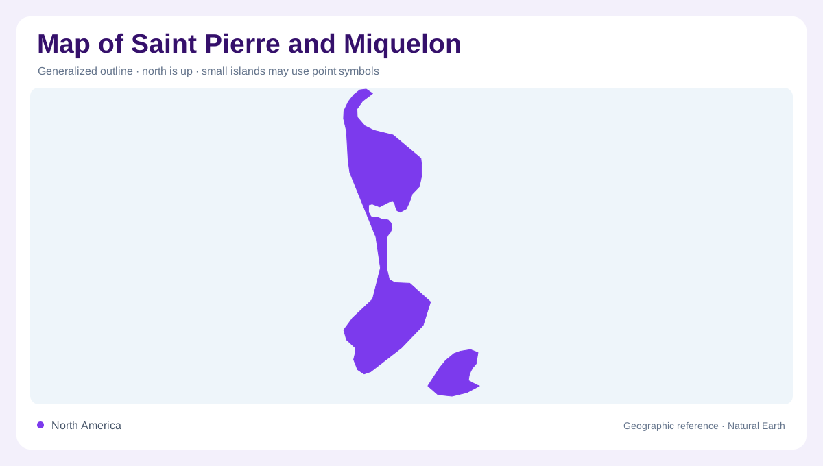
Saint Pierre and Miquelon is a small French archipelago in the North Atlantic, near Newfoundland's southern coast. Read it as several islands, not one compact territory. Saint-Pierre is the urban island, while Miquelon and Langlade form the larger northern landmass, joined by a long sandy isthmus. Small islands and rocks add further pieces around the main coast. The sea is not empty space here: it separates communities, shelters harbours, and creates lagoons and channels that control the shape seen on a map. A regional locator first establishes the archipelago's position; a local map then explains its unusual north-south arrangement.
Saint-Pierre, the island-port
Saint-Pierre developed around a protected cove enclosed by several islands, which made the site a natural port for fishing and commerce. The town occupies the southern island's most concentrated built area, with the coast and harbour providing orientation. Île-aux-Marins lies nearby as a separate island, not a waterfront neighborhood, and preserves a maritime landscape. Offshore references such as Grand Colombier and the Cap Percé coast help place Saint-Pierre within the wider archipelago rather than at the edge of an undifferentiated sea. On a map, harbour shelter and island separation explain the town's location better than a simple point label.
Miquelon and Langlade joined by La Dune
Miquelon-Langlade is the archipelago's northern landmass. Miquelon and Langlade are connected by La Dune, a sandy isthmus twelve kilometres long that narrows the water between their shores. The village of Miquelon sits on the northern island, while Langlade extends southward as a landscape of beaches, capes, ponds, and rolling ground. The isthmus is more than a thin line on the map: it controls movement between the two parts and creates sheltered water on one side and open Atlantic exposure on the other. Its shifting sand and history of shipwrecks underline the difference between solid high ground and coastal barrier terrain.
Lagoons, dunes, heaths and sea cliffs
The archipelago's geography is built from contrasts. Grand Barachois and other lagoons sit beside dunes and sandy beaches, while rocky shores and capes face deeper water. Heaths, forests, ponds, and low morne hills spread across Miquelon-Langlade, creating a landscape quite different from Saint-Pierre's port setting. The official tourism description groups the scenery as sea and lagoons, moorland and woodland, sand and rock; those pairings are useful map categories because they show how quickly land cover changes between exposed coast and sheltered interior. Marine space also matters: islands, channels, and shoals form a connected coastal system rather than isolated scenic points.
How to read the archipelago at two scales
At country scale, the archipelago can look like small marks off Canada, but that hides its internal geography. Zooming in should reveal Saint-Pierre's protected port, Île-aux-Marins, the northern village of Miquelon, the La Dune isthmus, Langlade's open coast, and the lagoons behind the shore. Do not merge Miquelon and Langlade into a single feature without showing their sand connection, and do not treat every offshore rock as inhabited land. The useful map combines administrative identity with physical form: settlement is concentrated in particular harbour or village sites, while much of the archipelago remains defined by water, dunes, wetlands, and exposed Atlantic margins.