Two volcanic islands in the Gulf
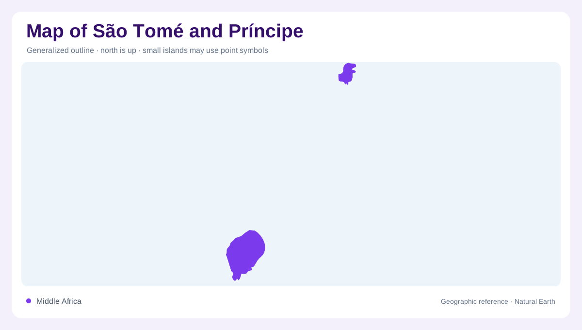
São Tomé and Príncipe is a compact archipelago in the Gulf of Guinea, close to the Equator and roughly 380 kilometres from Africa’s western coast. Its two principal islands are not adjacent: São Tomé occupies the southern and larger position, while Príncipe lies about 150 kilometres to the north. The national outline therefore reads as two separate volcanic landmasses rather than one continuous island. Several smaller islets complete the picture, but the two main islands dominate most maps. There are no land borders. Nearby reference points include Gabon, Equatorial Guinea, Cameroon, and Nigeria, useful for orienting this small country within the Gulf. This explains why the national map has two strong focal areas.
São Tomé’s rugged relief
São Tomé covers about 850 square kilometres and carries the archipelago’s broadest relief. Ancient volcanic activity produced a deeply dissected surface, so interior contours tighten quickly away from the coast. Steep ridges divide the volcanic interior, while coastal strips provide the gentler places where settlement and transport can spread. On a physical map, the island’s centre and south appear more elevated and broken than the perimeter. The six São Tomé districts—Água Grande, Mé-Zóchi, Lobata, Lembá, Cantagalo, and Caué—are administrative overlays; they should not be mistaken for separate islands or uniform terrain.
Príncipe's contrasting halves
Príncipe's terrain changes markedly between north and south. Much gentler northern ground gives way to a southern mountain range with phonolitic peaks, where remnants of primary rainforest occupy steep slopes. UNESCO describes summits between 500 and 948 metres in this southern massif. Valleys carry streams through the rugged sector, whereas the northern plains contain more standing water. This physical division matters more than an island silhouette alone. Santo António supplies the island's principal settlement reference. Offshore, Bom Bom and the Tinhosas islands belong to a wider biosphere landscape that includes both terrestrial habitats and surrounding marine waters.
Water, climate, and map texture
Relief controls more than altitude here. The official geographic profile describes a humid tropical climate with a long rainy season from September through June and a relatively drier Gravana from June through September. Slopes can therefore create sharp local contrasts in cloud, vegetation, and drainage even across short distances. Rivers and ravines are best interpreted as products of steep volcanic ground, not evidence of a broad continental plain. A map reader should expect dense green interiors, narrow coastal margins, and headlands shaped by weathering. Seasonal labels describe a national pattern, while the terrain explains why conditions vary from one coast to another.
Forests, islets and ocean habitats
The country's volcanic isolation has produced distinctive plant and animal communities. Príncipe's biosphere reserve includes forests, palm stands, riparian habitats and coastal ecosystems, connecting upland environments with the sea. Its offshore waters and islands support seabirds, turtles and cetaceans, while reefs introduce another habitat below the visible shoreline. Such features cannot be represented by district boundaries alone. On São Tomé, the six districts subdivide one larger island; around Príncipe, named islets extend the physical outline beyond the main shore. Together these scales reveal a country composed of separate volcanic landscapes, each embedded in a broader ocean environment.