An Atlantic-facing national outline
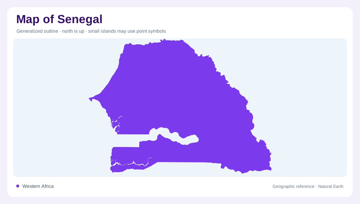
Senegal occupies a broad Atlantic-facing position on West Africa’s western shoulder. Its map is longer from north to south than the compact capital region suggests, and the coast remains the country’s clearest western edge. Four river systems help orient the interior: the Senegal, Gambia, Casamance, and Saloum. Their valleys, floodplains, estuaries, and deltas break up the dry-looking national outline. The official tourism profile separates Dakar, Saint-Louis, Casamance, the Senegal Oriental, the Petite Côte, and Sine Saloum, a useful regional framework because each name points to a different relationship between water, settlement, and vegetation. The Gambia extends inland along its namesake river, separating southern Casamance from Senegal's northern and central areas.
Dakar and the Cap-Vert peninsula
Dakar sits at the extreme west on the Cap-Vert peninsula, projecting into the Atlantic rather than lying deep within the mainland. The official destination page places the city beside ocean beaches, offshore islands, fishing villages, and the volcanic Mamelles hills. On a map, the peninsula’s hooked coastline explains Dakar’s maritime orientation and dense urban footprint. Gorée, Ngor, and the Îles de la Madeleine appear as nearby islands, not extensions of the peninsula. Keep the map zoomed in when reading these small features: at national scale they may disappear, yet they clarify the shape of Senegal’s westernmost edge.
Northern plains, dunes, and river country
North of the central coast, the landscape trends toward dry plains, dunes, and river country. The tourism authority identifies Lompoul as a desert belt in the northwest and describes longer rainy seasons toward the country's southern districts. The Senegal River provides a contrasting linear feature, while the Lac Rose near Dakar is a separate inland lake rather than a coastal lagoon. Reading these features together prevents a false impression that all pale areas are identical: dunes, seasonal surfaces, river floodplains, and salt or lake margins produce different map signatures. The contrast is especially useful when a shaded map uses similar tones for sand and dry grass.
Sine Saloum’s island maze
South of the Petite Côte, the Sine Saloum becomes an intricate maze of channels. The official regional description highlights a chain of islands set among mangroves, bolongs, and lagoons, with Toubacouta, Foundiougne, Palmarin, Dionewar, Niodor, and Djiffer as named reference points. Here the coastline is not a simple line; tidal waterways and low islands create a branching texture. A physical map should therefore be read from water inward, following creeks before assuming that every green patch is mainland. The delta’s geography also explains its importance for fish, birds, and mangrove habitats.
Casamance and the eastern transition
Casamance gives the south a wetter, more forested character, with coastal beaches and a river corridor distinct from the drier north. Farther east, the Senegal Oriental leads toward savanna and upland country, so the national map changes from maritime lowlands to inland relief. Use Dakar as the western anchor, Saint-Louis and the Senegal River as the northern guide, Sine Saloum as the deltaic hinge, and Casamance as the southern reference. That sequence makes Senegal legible as a set of connected landscapes, not just a flat coastal country. The Gambia's river corridor interrupts a direct coastal sequence.