Separated northern lands
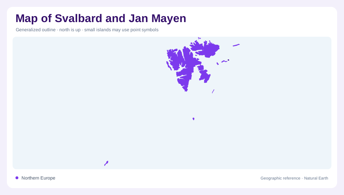
Svalbard and Jan Mayen share a statistical label, but they are not one archipelago. Svalbard lies between mainland Norway and the North Pole, whereas Jan Mayen is an isolated volcanic island much farther southwest in the North Atlantic. A combined map therefore spans two distinct landscapes separated by open water. Enlarged panels help reveal their coastlines, provided a locator preserves the distance between them. Both belong to Norway, yet their grouping should not imply a single local administration or continuous island chain. The contrast begins with form: Svalbard spreads across several large islands; Jan Mayen concentrates around one volcanic ridge.
Spitsbergen and Nordaustlandet
Spitsbergen is Svalbard's principal island and contains Longyearbyen, a useful settlement anchor amid a much larger landscape of mountains, valleys and ice. Across the archipelago, coastlines indent around fjords rather than forming smooth island margins. Nordaustlandet, the second largest island, makes the northeastern part of the group especially conspicuous on an ice map. NASA satellite observations show extensive glacier coverage and summer melt across Svalbard, including meltwater carrying sediment toward coastal waters. Such images represent particular dates, not permanent shoreline conditions. Rock, glacier ice, seasonal snow and open water need separate interpretation when comparing an aerial view with a map.
Edgeøya and moving ice
Edgeøya occupies the southeastern part of Svalbard. Its interior ice cap, Edgeøyjøkulen, feeds Stonebreen, a glacier reaching the Barents Sea. This named connection gives a more precise picture than describing the entire archipelago simply as frozen land. The glacier links an elevated accumulation area with a marine margin, where ice loss and movement reshape the boundary visible in satellite imagery. NASA describes changes in Stonebreen's speed, including seasonal movement and a longer surge episode. A mapped glacier front is consequently a dated coastal observation. The surrounding island remains the geographic reference even as the glacier's outline and surface drainage change.
Beerenberg above the Atlantic
Jan Mayen presents a different profile: Beerenberg rises above its eastern end, with snow and ice covering the volcanic summit. NASA imagery places this isolated Norwegian island in the North Atlantic near the Greenland Sea and shows how its relief interrupts passing air. Under suitable conditions, alternating cloud swirls develop downwind, revealing an atmospheric wake behind the mountain. That pattern illustrates the height of the volcanic obstacle without requiring a settlement network to explain the landscape. At island scale, the dominant relationship is between steep volcanic ground and surrounding sea; at regional scale, isolation is the most immediately visible feature.
Coasts at different scales
Longyearbyen provides a human reference for Svalbard, but it cannot stand in for the archipelago's extensive glaciated terrain. The Governor of Svalbard describes environmental protection in terms of connected wilderness, wildlife and cultural heritage, an approach consistent with the scale of these islands. Jan Mayen requires its own enlargement because it would otherwise become a tiny mark beside the larger northern group. Neither inset should imply that glaciers, snow cover or marine conditions remain fixed throughout the year. Reading both components together reveals two expressions of northern geography: an intricate polar archipelago and an isolated volcanic island amid Atlantic waters.