Island at a strait edge
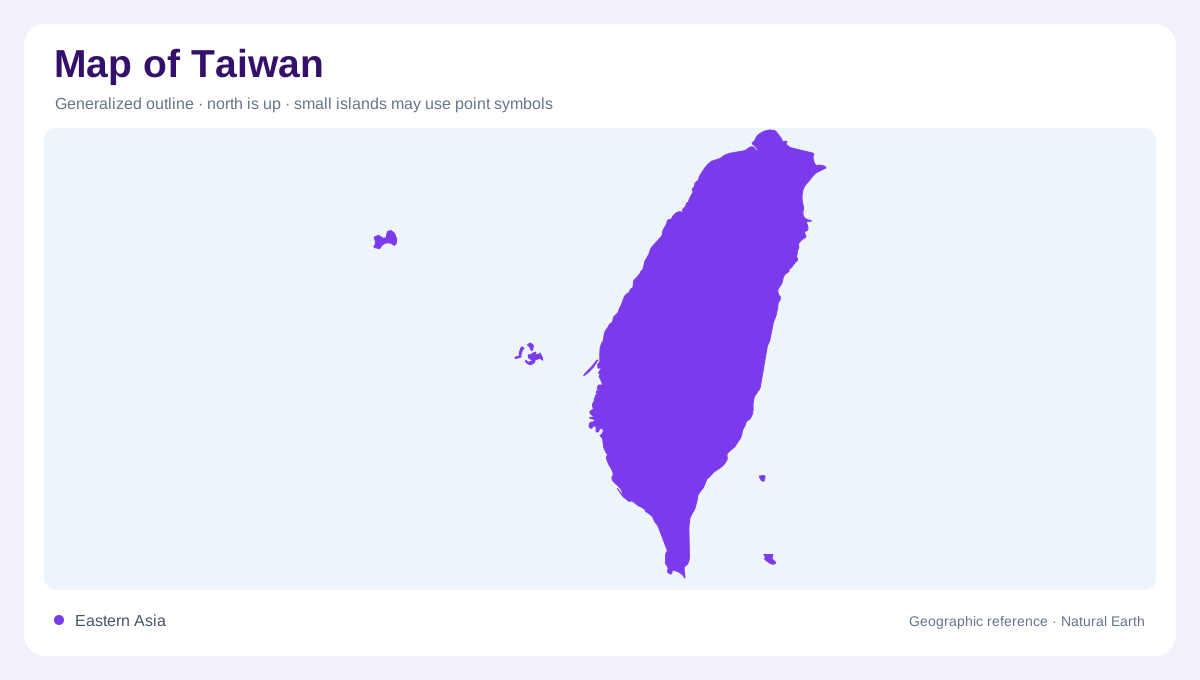
Taiwan's main island lies between the Taiwan Strait and the western Pacific, so the first map distinction is west-facing strait coast versus east-facing ocean coast. The island is longer north to south than east to west, with Taipei near the northern basin, Kaohsiung on the southwest coast and Hualien and Taitung along the eastern side. Offshore groups add important context: Penghu sits in the strait, while Kinmen and Matsu lie close to the mainland coast. Those islands should be shown as separated insets or clearly scaled labels.
Mountain spine
Taiwan is often described by its central mountain spine, and the official Tourism Administration page calls it an alpine island with diverse topography. The Central Mountain Range and related ranges run roughly north-south, pushing steep slopes close to the Pacific side. Yushan, Snow Mountain and other high summits make the island far more vertical than its compact outline suggests. On a physical map, contours explain why east-west travel is constrained, why short distances can involve major elevation change, and why rivers descend rapidly from the interior. Because typhoon rainfall and steep catchments place reservoirs, alluvial fans and floodplains close together, a Taiwanese water map should be read with relief in view, not as a flat network of channels. That pairing explains why western lowland rivers can be short yet heavily managed, while eastern streams descend through gorges before meeting narrow coastal plains. It also keeps mountain parks visible beside major cities on compact national maps.
Western plains and cities
The western side carries Taiwan's broadest lowlands and its densest chain of cities. Taipei, Taoyuan, Hsinchu, Taichung, Tainan and Kaohsiung occupy basins, fans and coastal plains that face the strait. Rivers descending from the mountains spread sediment into these lowlands, creating agricultural and urban corridors. This pattern is easy to miss on a small island map because the cities can appear evenly spaced. In reality, the west is a linked belt of plains and transport corridors, while the east is narrower, steeper and more segmented.
Eastern coast and water
Eastern Taiwan has a different map logic. Mountains approach the Pacific, leaving a slimmer inhabited strip around Hualien, the East Rift Valley and Taitung. Rivers are shorter and steeper than those of large continental basins, so drainage maps look like many quick descents rather than one dominant river system. The Xiuguluan River crosses the coastal mountains, connecting the valley's drainage with the Pacific rather than remaining enclosed between parallel ridges throughout its course. For orientation, the Rift Valley, coastal range and Pacific shoreline deserve separate labels.
Scale and offshore context
Taiwan's geography can be distorted if offshore islands are squeezed into one frame without scale cues. Penghu belongs visually to the Taiwan Strait, Kinmen and Matsu to the mainland-edge island chain, and the main island to the mountain-and-plain system farther east. A useful map therefore combines a detailed main-island panel with locator insets for separated groups. Green Island and Orchid Island sit off the southeastern coast. For map reading, the stable facts are enough: a mountainous main island, contrasting coasts, dense western lowlands and several offshore components.