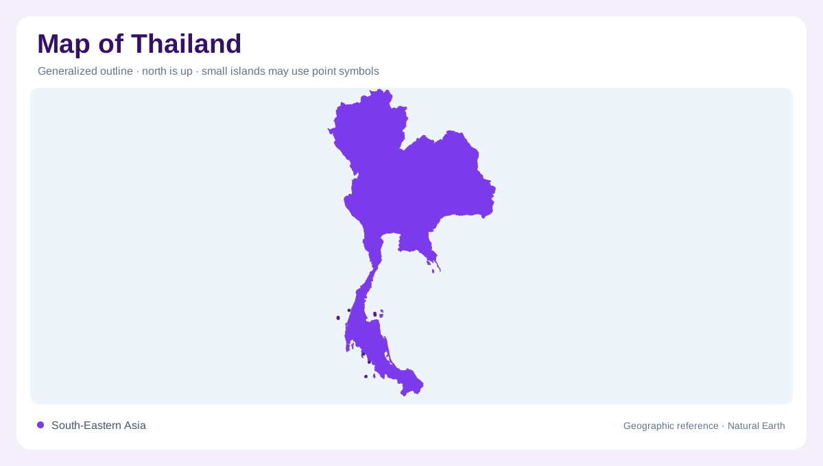
A mainland and peninsular country
Thailand's outline combines a broad mainland body with a long southern peninsula. Myanmar lies to the west and northwest, Laos to the northeast across much of the Mekong, Cambodia to the east and Malaysia to the south. The Gulf of Thailand curves into the southeast and central south, while the Andaman Sea borders the western side of the peninsula. This shape means national scale changes quickly: the north and northeast are continental, Bangkok sits on a low central plain, and the far south narrows between two marine coasts.
Four physiographic regions
FAO's AQUASTAT profile summarizes Thailand with four physiographic regions: mountainous north, dry northeastern plateau, extensive central plain and southern peninsula. That is the simplest reliable framework for a map. The northern mountains contain headwaters and forested relief around Chiang Mai and beyond. The northeast, commonly associated with the Khorat Plateau, faces the Mekong and has a different dry-season character. The central plain is broad, low and flood-prone, while the peninsula is segmented by coastal ranges, bays and narrow cross-country distances.
Central plain and Bangkok
The Chao Phraya system makes central Thailand one of Southeast Asia's classic river plains. Bangkok sits near the river's lower reach and deltaic lowlands, where canals, flood controls, ports and urban expansion overlay the natural map. North of the capital, Ayutthaya and the lower basin show why water movement matters: many routes and settlements follow levees, distributaries and higher ground beside floodable land. A useful map should therefore distinguish the central plain from the uplands around it, because elevation changes are subtle but geographically decisive. Scale changes are especially sharp around Bangkok, where a national dot represents a broad metropolitan delta, and around the peninsula, where bays can face opposite seas within a short overland distance. Northern provincial maps also need room for ridges and basins, because Chiang Rai, Chiang Mai and Mae Hong Son relate to border highlands differently than towns on the central plain or the lower Chao Phraya floodplain near Bangkok itself.
Border rivers and basins
Thailand shares several important river systems with neighbors. The FAO profile notes the Mekong as a natural boundary with Laos, the Salween along part of the Myanmar border, and the Kolok on the Malaysian border. Internally, river basins are often discussed in many subbasins rather than one national drainage. On a map this creates a branching logic: the north sends water toward the central plain, the northeast relates to the Mekong, and southern streams descend short distances to either the Gulf of Thailand or the Andaman Sea.
Reading the peninsula
Southern Thailand should not be reduced to beach labels. The peninsula is a long, narrow geographic bridge with mountains, short rivers, karst areas, bays and islands on both sides. Phuket faces the Andaman Sea; Surat Thani and Songkhla relate to the Gulf of Thailand; the far south connects toward Malaysia. Because the strip is narrow, small map shifts can place a town on the wrong coast if labels are careless. Thailand is best read as connected regions: mountain headwaters, northeast plateau, central floodplain, eastern coastlands and a two-sided southern peninsula.