Two unequal islands
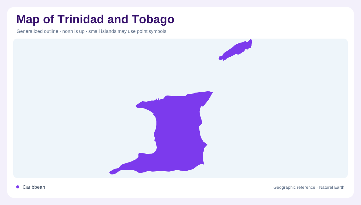
Trinidad and Tobago should be read as a twin-island country with unequal geographic weight. Trinidad is the larger, southern island, lying close to the Venezuelan coast; Tobago sits northeast across a channel. FAO's country profile describes the republic as the southernmost part of the Caribbean island chain and notes the short distance from Venezuela, which explains why Trinidad's map feels tied to South America as well as the Caribbean. The two main islands should not be merged visually. Trinidad carries most land area, major plains, and urban concentration, while Tobago adds a smaller, hillier, marine-facing island geography. This dual identity shapes every overview map.
Trinidad's physical belts
Trinidad's terrain is organized by east-west ranges and intervening lowlands. The Northern Range rises along the island's upper edge and visually continues the coastal mountain logic of nearby Venezuela. Central and southern relief is lower, with plains, wetlands, and rolling terrain that support settlement and agriculture. Port of Spain sits near the northwest, facing the Gulf of Paria, while San Fernando anchors the western side farther south. The Caroni lowlands, Nariva Swamp, and southern coastal districts create different map textures. Road and settlement patterns are easier to understand after first identifying those physical belts. Those belts also explain why north-south crossings feel selective.
Tobago's compact relief
Tobago is smaller but not secondary in geographic character. Its Main Ridge runs through the island, producing a more compact, elevated landform with short drainage paths toward both Caribbean and Atlantic-facing shores. Scarborough sits on the southwest coast, while the island narrows and bends toward the northeast. Beaches, reefs, and bays appear close together at island scale, but the ridge makes inland crossing more meaningful than the size suggests. A good map gives Tobago enough room to show relief, settlement, and coastlines separately rather than treating it as an inset dot beside Trinidad. Inset maps should preserve that local complexity.
Water and wetland clues
Water geography differs between the islands. Trinidad has larger watersheds, swampy lowlands, and the sheltered Gulf of Paria, while Tobago's streams descend quickly from the Main Ridge. FAO's fact sheet records high average precipitation and both surface-water and groundwater withdrawals, supporting a reading of water as a real planning feature, not decoration. The islands also face different marine settings: Trinidad looks toward Venezuela, the Atlantic, and the Gulf; Tobago faces open water and reef-fringed coasts. Maps should show gulfs, channels, and wetlands alongside towns, because they explain orientation and land use. This contrast matters when comparing watershed labels.
A hinge in the Caribbean
At regional scale, Trinidad and Tobago occupies a hinge position between the Lesser Antilles and northern South America. That location affects how readers interpret climate, biodiversity, offshore waters, and cultural routes without needing current travel claims. The country is not a single resort island, nor a mainland extension; it is a paired island system with contrasting size, relief, and coastal exposure. Start with the Venezuela-facing south, then move across the Tobago channel, then compare each island's interior. The clearest map reading keeps the republic's twin structure visible at every scale. That habit prevents visual imbalance.