Two island groups
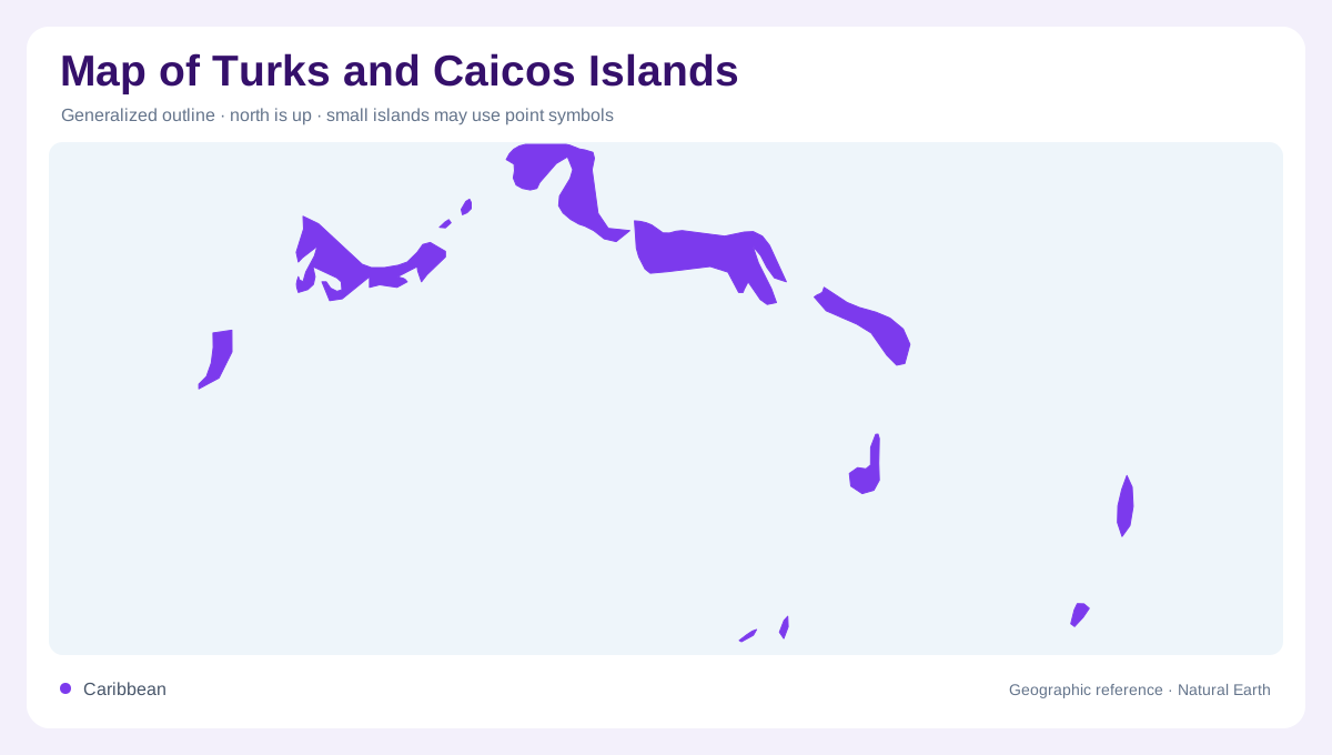
The Turks and Caicos Islands are a low Atlantic archipelago often grouped with the Caribbean, but their map position is southeast of the Bahamas and northeast of Cuba, north of Hispaniola. The official tourism quick-facts page describes more than 40 islands and cays, with eight inhabited islands divided by the Turks Island Passage. That passage is the first feature to find. Grand Turk and Salt Cay lie to the east as the Turks Islands, while the Caicos group spreads west with Providenciales, North Caicos, Middle Caicos, South Caicos, Pine Cay, and Parrot Cay among the inhabited islands. This split controls the territory's layout.
The Caicos bank
The Caicos side dominates the map by area and shallow-bank geography. Providenciales is the best-known settlement and service hub, but it is only one part of a broader chain. North Caicos and Middle Caicos form larger landmasses with wetlands, limestone interiors, and long shorelines, while South Caicos sits apart on the southeastern bank edge. Pine Cay and Parrot Cay are smaller inhabited cays between larger islands. A reader should treat the Caicos group as a bank-and-cay system, where pale shallow water, reefs, channels, and island spacing explain the shape more clearly than land area alone. Bank edges matter as much as shorelines.
Grand Turk and Salt Cay
Grand Turk and Salt Cay form the smaller eastern group, separated from the Caicos Islands by deep water. Grand Turk contains Cockburn Town and reads as a compact island with a narrow settlement pattern, salt-pond history, and reef-edged coast. Salt Cay is smaller, lower, and visually distinct, so it should not disappear behind the Grand Turk label. The Turks Island Passage is not empty space; it is the geographic divider that makes the territory compound. Maps that show both groups at equal clarity help prevent the eastern islands from becoming an afterthought beside Providenciales. Their separation is the map's eastern lesson.
Low islands and rainfall
Freshwater and relief are limited across the territory. The important physical clues are limestone surfaces, salinas, mangroves, beaches, reefs, banks, and channels rather than mountains or rivers. Rainfall also varies across the islands; the official quick-facts page notes lower annual rainfall on Grand Turk and South Caicos than farther west. That difference is useful for understanding vegetation and settlement constraints, but maps should avoid exaggerating it into a sharp climate boundary. For practical geographic interpretation, shallow-water color, protected wetlands, and reef margins often carry more information than contour lines. Those subtle clues suit low-island mapping.
How to read the territory
A good map of the Turks and Caicos Islands should work at three scales. Regionally, it shows the Atlantic position south of the Bahamas and near Cuba and Hispaniola. Territorially, it separates the Turks Islands from the Caicos Islands across the passage. Locally, it names individual islands and cays without implying continuous land between them. Because the territory is made of banks, cays, channels, and low limestone islands, blue water is the main organizing space. The clearest reading follows island groups first, then inhabited islands, then reefs, salinas, and settlement areas. That order keeps the compound territory clearly legible.