Three main island settings
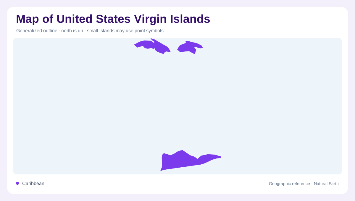
The United States Virgin Islands occupy part of the northeastern Caribbean, east of Puerto Rico. The map is anchored by St. Thomas, St. John and St. Croix, with Water Island and smaller cays adding local detail. St. Thomas and St. John sit close together, separated by narrow water, while St. Croix lies farther south across a broader passage. This separation matters because a small locator map can compress the islands into one cluster. A useful map should keep the relative spacing visible, then zoom in for bays, reefs and settlement patterns around each island. The northern islands align with the Virgin Passage and Pillsbury Sound, while St. Croix sits by the Caribbean Sea. Pillsbury Sound separates St. Thomas from St. John's western coastal bays.
St. John and steep coastal relief
St. John is strongly shaped by steep terrain. The National Park Service describes Virgin Islands National Park as mountainous, with average slopes of about 30 percent and Bordeaux Mountain rising 1,286 feet before dropping sharply toward the sea. That relief explains why bays, ridges and short valleys dominate detailed maps. Roads and trails bend around slopes rather than crossing a flat grid. Salt ponds, beaches, mangroves, seagrass beds and coral reefs sit close to dry or moist forest. On St. John, land and marine geography need to be read together, not as separate panels.
St. Thomas, Water Island and cays
St. Thomas carries many of the territory's compact settlement labels, yet its physical shape is still hilly and deeply indented. Charlotte Amalie's harbor geography belongs to a sheltered south-facing coast, while ridges rise behind the urban waterfront. Water Island lies immediately to the south, small enough to be missed if labels are crowded. Nearby cays help define channels and anchorages. A map that exaggerates only town names can make the island look simpler than it is. Relief shading, bay names and marine channels give a clearer picture of how people and coastlines occupy limited land.
St. Croix and Buck Island
St. Croix is the largest of the main islands and sits apart from St. Thomas and St. John. Its longer east-west outline, coastal plains and interior hills create a different map pattern. North of St. Croix, Buck Island Reef National Monument protects a small island and the coral reef system around it. The National Park Service describes Buck Island's elkhorn-coral barrier reef as unique within U.S. waters. That fact is important cartographically because the monument is not just dry land. Reef boundaries, shallow water and the surrounding marine setting are part of the geographic subject.
Reading land and sea together
The territory is easiest to interpret as an island-and-water network. St. Croix should be set off in its southern position, while St. Thomas, Water Island and St. John require a closer northern inset. Marine protected areas, coral reefs, salt ponds, mangroves and seagrass beds make water features as meaningful as roads. Because slopes are steep in parts of the territory, distance on the map does not always imply easy movement across land. A good geographic reading moves from island spacing to local relief, then to bays and reefs that shape each shoreline.