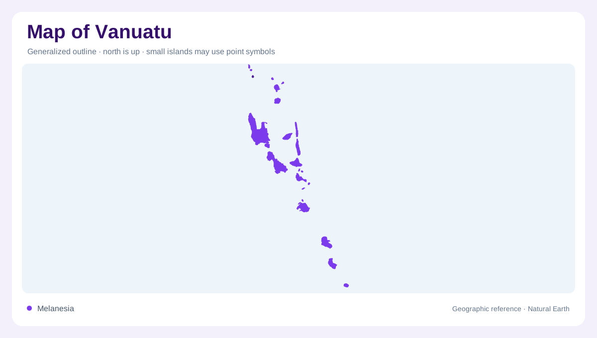
A long Pacific arc
Vanuatu appears on a regional map as a broken north-south arc in the South Pacific rather than one compact landmass. The country is made of about eighty islands, and roughly sixty-five are inhabited. Its six provinces, Torba, Sanma, Penama, Malampa, Shefa and Tafea, follow island groupings more than straight administrative geometry. That matters when reading distance: Sola in the Banks and Torres area, Luganville on Espiritu Santo, Lakatoro on Malekula and Port Vila on Efate are separated by open water, not by a continuous road network.
Large islands anchor the chain
The largest islands give the map its scale. Espiritu Santo dominates the northwest, Malekula sits to its southeast, Efate holds the capital, and Erromango and Tanna extend the southern sequence. Pentecost, Ambrym, Epi, Aoba, Maewo, Vanua Lava and Gaua appear as smaller but important stepping stones through the middle and north. A national outline therefore rewards careful zooming: many names that look close on a page are separated by channels, reefs and steep volcanic slopes.
Volcanic slopes and short streams
Relief is central to Vanuatu's geography. FAO's map marks Mount Tabwemasana on Espiritu Santo, while the country profile describes high raised volcanic islands with rivers, streams and groundwater. Most stream courses are short because individual islands are small and rugged. Efate, Malekula, Espiritu Santo and Pentecost are the main exceptions where perennial watercourses are more likely to matter on a national map. Elsewhere, ravines and seasonal flow can be locally significant without forming long mainland-style drainage systems.
Water differs by island type
Vanuatu's water geography changes sharply between high volcanic islands and low coral islands. The former can hold streams and groundwater; the latter often depend on rain tanks or freshwater lenses above salt water. Some small islands have neither reliable surface water nor useful groundwater. This contrast explains why a simple blue-line map can mislead. The absence of a visible river does not mean a place is empty, while a named river on Santo or Efate may represent one of the country's more dependable freshwater settings.
Reading settlements by sea
Settlement labels should be interpreted through maritime geography. Port Vila faces Efate's harbor setting; Luganville lies on Santo; Lakatoro serves Malekula; Isangel helps locate Tanna; and Longana marks Ambae. These centers are not points along one highway but nodes in an archipelago. A useful Vanuatu map therefore balances island names, provincial groupings, volcanic peaks and sea passages. The surrounding Pacific is not background space; it is the organizing surface across which administration, travel and local identity are arranged. On detailed maps, the chain also bends enough that north, center and south are more useful than a single island-to-island sequence. Torba's northern islands face different neighbors than Tafea's southern islands, and Sanma's Santo is large enough to hold several mapped valleys of its own. This scale shift is important for any inset or locator map. It prevents the whole country from becoming a decorative scatter of dots, and it keeps Espiritu Santo, Malekula, Efate and Tanna visible as distinct geographic anchors within the archipelago's broader volcanic arc. The result is a map needing both overview and close reading.