A state stretching across the grain
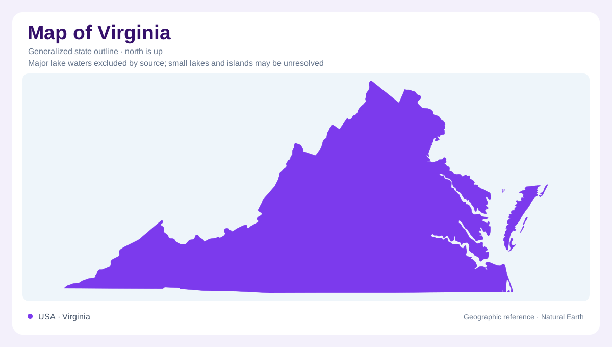
Virginia reaches from Appalachian country in the west to the Atlantic coast in the east. Its long southwestern extension and indented eastern shore make the outline more complicated than a simple strip between mountains and sea. Chesapeake Bay also separates the Eastern Shore from the larger mainland portion of the state. Inside this boundary, major physical regions generally follow the Appalachian alignment, so an eastward journey crosses their grain. The Blue Ridge, Piedmont, and Coastal Plain provide successive reference points. Farther west, parallel ridges and valleys and the Appalachian Plateau add landscapes that cannot be inferred from the coastline alone.
Folded country west of the Blue Ridge
The Valley and Ridge province consists of elongated ridges and valleys developed on folded sedimentary rocks. Erosion removes weaker layers more readily, leaving resistant belts as higher ground. Because folding repeats these belts, the landscape acquires its characteristic parallel pattern. Streams commonly follow a trellis arrangement, with smaller channels entering longer valleys from the sides. The Great Valley includes the Shenandoah Valley in central and northern Virginia. Carbonate rocks beneath it help explain caverns and other karst features formed by dissolution. A broad valley can therefore contain substantial underground drainage rather than directing every stream continuously across its visible surface.
The Blue Ridge and its eastern foothills
Shenandoah National Park follows the Blue Ridge, whose rocks preserve several episodes of mountain building and erosion. Ancient metamorphic rocks, younger volcanic rocks, and sedimentary deposits occur within the range. The modern mountains are the worn remnants of a much older and more complex history, not newly raised peaks. Eastward, the Piedmont has gentler rolling relief, although resistant rocks form isolated hills and increasingly rugged foothills near the ridge. Deep weathering commonly conceals bedrock beneath a thick mantle of altered material. Stream valleys expose rock where flowing water has removed this cover, making drainage a guide to otherwise hidden geology.
Where upland rivers become tidal corridors
The Fall Zone marks the transition from the Piedmont's resistant rocks to the younger sedimentary layers of the Coastal Plain. Streams descend across this relatively narrow belt before continuing through lower country. The James, York, Rappahannock, and Potomac cross the Coastal Plain toward Chesapeake Bay, creating broad tidal corridors near their lower reaches. The land between them is not one perfectly flat surface. Terraces descend toward the rivers and coast, preserving former shorelines and waterbody floors. Farther inland, older surfaces have experienced more stream erosion. This sequence gives eastern Virginia a fine network of peninsulas, river valleys, and stepped interfluves.
Two shores facing different waters
Chesapeake Bay opens into the Atlantic, while Virginia's Eastern Shore has a bayward side and an oceanward side. Low barrier islands fringe its Atlantic margin. These islands and the mainland coast respond to sediment movement, waves, and changes in sea level, unlike the fixed lines used to identify counties or states. The Coastal Plain also extends seaward beneath younger deposits, so today's shore is only the present meeting of land and water. For geographic orientation, distinguish the bay, its tidal tributaries, and the open ocean. Their separate positions explain much of the branching shape of Virginia's eastern edge and waterways.